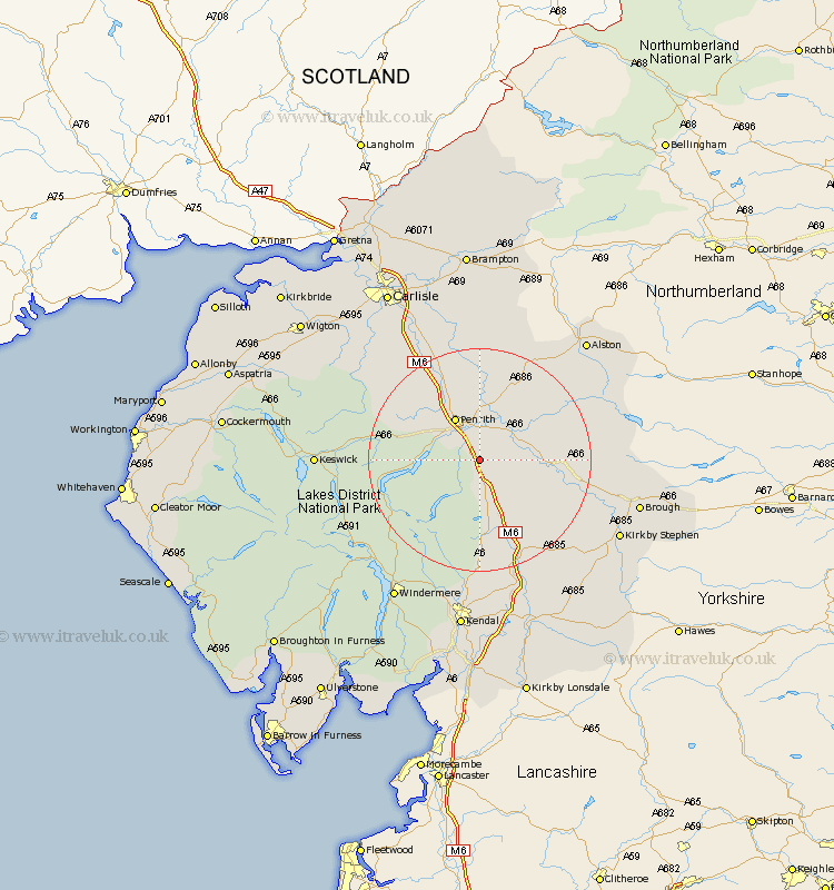
Cumbria Map Showing Location of Hackthorpe
District: Eden
Easting: 354782 Northing: 522996
Latitude: 54.6 Longitude: -2.7
 = Hackthorpe
Easting: 354782 Northing: 522996
Latitude: 54.6 Longitude: -2.7
= Hackthorpe
This Hackthorpe map below is supplied by Google. Use the tools in the top left corner to zoom into street level or zoom out for a road map, you may also need to zoom in to see Hackthorpe on the map. Click and drag the map to move around. If the map fails to load try and refresh your browser or zoom in or out (+ or -).
Update - it seems Google no longer allow people to use their maps for free! This Hackthorpe map sometimes loads and sometimes gives a error. I am working on a solution.
Closest 30 Towns or Cities to Hackthorpe (Population over 500)
Culgaith 8.51km Dacre 8.79km Langwathby 9.51km Shap 9.51km Kirkby Thore 9.84km Long Marton 11.81km Long Marston 11.81km Crosby Ravensworth 11.93km Greystoke 12.08km Appleby 14.45km Lasonby 14.82km Lazonby 14.82km Skelton 15.45km Orton 17.14km Kirkoswald 18.54km Tebay 21.73km Ainstable 22.34km Hesket Newmarket 25.19km Ambleside 26.68km Koswick 26.84km Keswick 26.84km Caldbeck 26.95km Kirkby Stephen 27.01km Staveley 27.01km Ravenstonedale 27.39km Brough 27.4km Windermere 29.48km Wetheral 30.59km Kendall 31.67km Kendal 31.67km