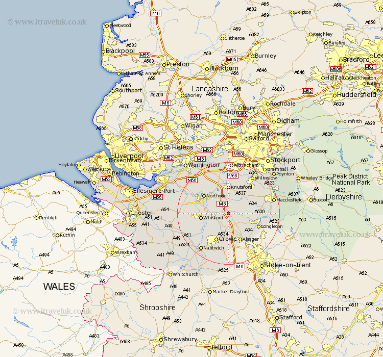
Cheshire Map Showing Location of Holmes Chapel
Population: 5287
Area Size (ha): 161
District: Congleton
Easting: 375508 Northing: 367085
Latitude: 53.2 Longitude: -2.37
 = Holmes Chapel
Area Size (ha): 161
District: Congleton
Easting: 375508 Northing: 367085
Latitude: 53.2 Longitude: -2.37
= Holmes Chapel
This Holmes Chapel map below is supplied by Google. Use the tools in the top left corner to zoom into street level or zoom out for a road map, you may also need to zoom in to see Holmes Chapel on the map. Click and drag the map to move around. If the map fails to load try and refresh your browser or zoom in or out (+ or -).
Update - it seems Google no longer allow people to use their maps for free! This Holmes Chapel map sometimes loads and sometimes gives a error. I am working on a solution.
Closest 30 Towns or Cities to Holmes Chapel (Population over 500)
Holmes Chapel 0km Goostrey 4.32km Brereton 4.32km Brereton cum Smethwick 4.32km Middlewich 4.81km Middlewick 4.81km Peover Superior 5.67km Peover 5.67km Sandbach 7.42km Plumley Station 8.13km Plumbley 8.13km Lostock Gralam 9.96km Chelford 9.97km Winsford 10.16km Davenham 10.65km Rode Heath 10.8km Knutsford 11.12km Marston 11.57km Northwick 11.57km Northwich 11.57km Crewe 11.97km Alsager 11.98km Whitegate 12.35km Congleton 12.42km Hartford 12.76km Alderley 12.83km Nether Alderley 12.83km Anderton 13.34km Mobberley 13.4km Gawsworth 13.45km