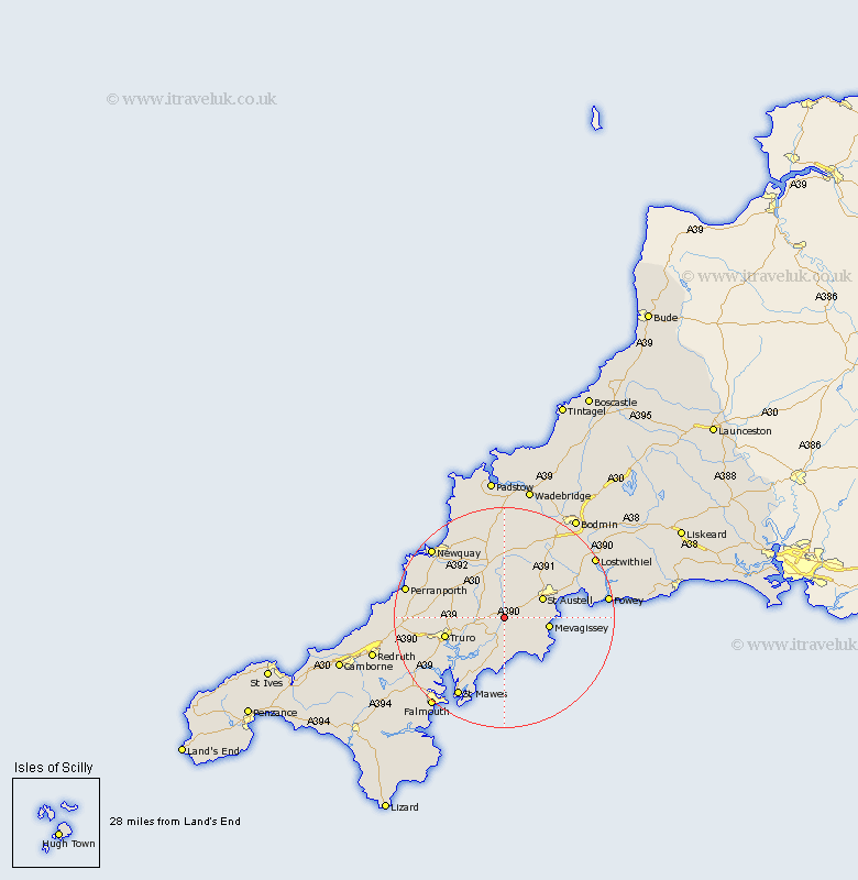
Cornwall Map Showing Location of Grampound
District: Restormel
Easting: 193497 Northing: 48541
Latitude: 50.3 Longitude: -4.9
 = Grampound
Easting: 193497 Northing: 48541
Latitude: 50.3 Longitude: -4.9
= Grampound
This Grampound map below is supplied by Google. Use the tools in the top left corner to zoom into street level or zoom out for a road map, you may also need to zoom in to see Grampound on the map. Click and drag the map to move around. If the map fails to load try and refresh your browser or zoom in or out (+ or -).
Update - it seems Google no longer allow people to use their maps for free! This Grampound map sometimes loads and sometimes gives a error. I am working on a solution.
Closest 30 Towns or Cities to Grampound (Population over 500)
Creed 1.86km St Stephen 3.7km Saint Stephen 3.7km St. Stephen 3.7km Tregoney 3.89km Ladock 4.01km Probus 4.01km St Ewe 6.01km Saint Ewe 6.01km St. Ewe 6.01km St Austell 8.01km Saint Austell 8.01km St. Austell 8.01km Mevegissey 8.49km Mevagissey 8.49km Saint Denis 9.34km St Dennis 9.34km St Denis 9.34km St. Dennis 9.34km St. Denis 9.34km Saint Dennis 9.34km Veryan 9.34km Truro 11.28km Bugle 11.67km Stenalees 12.06km Roche 12.08km Kenwyn 12.41km Kea 12.99km Par 14.15km St. Columb 15.01km