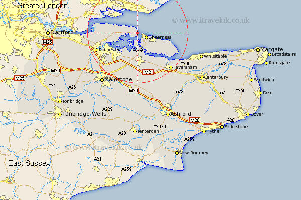
Kent Map Showing Location of Grain
Population: 1731
Easting: 588743 Northing: 175889
Latitude: 51.45 Longitude: 0.72
 = Grain
Easting: 588743 Northing: 175889
Latitude: 51.45 Longitude: 0.72
= Grain
This Grain map below is supplied by Google. Use the tools in the top left corner to zoom into street level or zoom out for a road map, you may also need to zoom in to see Grain on the map. Click and drag the map to move around. If the map fails to load try and refresh your browser or zoom in or out (+ or -).
Update - it seems Google no longer allow people to use their maps for free! This Grain map sometimes loads and sometimes gives a error. I am working on a solution.
Closest 30 Towns or Cities to Grain (Population over 500)
Sheerness 3.93km Allhallows 4.98km Queenborough 5.07km Stoke 7.18km Minster 7.86km Iwade 9.33km Lower Halstow 9.89km Upchurch 10.35km Bobbing 11.18km Newington 11.65km High Halstow 11.7km Hoo 11.79km Eastchurch 11.79km Gillingham 12.89km Sittingbourne 13.18km Warden 13.87km Teynham 14.71km Tunstall 14.82km Borden 14.87km Leysdown on Sea 14.94km Leysdown 14.94km Leysdown-on-Sea 14.94km Bapchild 15.22km Stockbury 15.53km Chatham 15.73km Bredgar 16.72km Strood 16.76km Linsted 17.31km Lynsted 17.31km Higham 17.43km