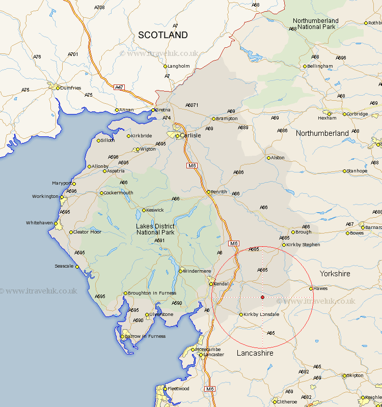
Cumbria Map Showing Location of Gawthrop
District: South Lakeland
Easting: 369608 Northing: 485789
Latitude: 54.27 Longitude: -2.47
 = Gawthrop
Easting: 369608 Northing: 485789
Latitude: 54.27 Longitude: -2.47
= Gawthrop
This Gawthrop map below is supplied by Google. Use the tools in the top left corner to zoom into street level or zoom out for a road map, you may also need to zoom in to see Gawthrop on the map. Click and drag the map to move around. If the map fails to load try and refresh your browser or zoom in or out (+ or -).
Update - it seems Google no longer allow people to use their maps for free! This Gawthrop map sometimes loads and sometimes gives a error. I am working on a solution.
Closest 30 Towns or Cities to Gawthrop (Population over 500)
Dent 1.08km Sedbergh 6.44km Milnthorpe 6.44km Millthrop 6.44km Kirkby Londsdale 10.61km Kirkby Lonsdale 10.61km Ravenstonedale 16.99km Natland 17.41km Tebay 18.31km Holme 18.71km Kendal 19.21km Kendall 19.21km Heversham 19.84km Milnthorpe 20.27km Levens 20.65km Beetham 20.86km Orton 23.16km Kirkby Stephen 23.49km Staveley 25.28km Arnside 25.58km Crosby Ravensworth 28.81km Brough 29.82km Shap 30.67km Windermere 31.23km Appleby 33.37km Lower Holker 33.8km Holker 33.8km Haverthwaite 35.92km Hawkshead 36.33km Ambleside 36.45km