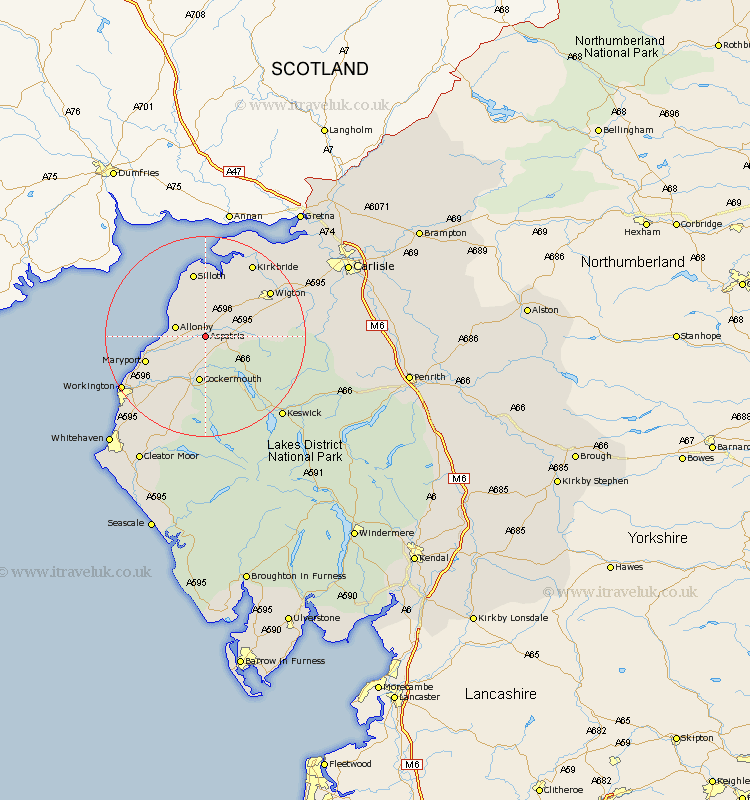
Cumbria Map Showing Location of Aspatria
Population: 2191
Area Size (ha): 72
District: Allerdale
Easting: 314190 Northing: 540276
Latitude: 54.75 Longitude: -3.33
 = Aspatria
Area Size (ha): 72
District: Allerdale
Easting: 314190 Northing: 540276
Latitude: 54.75 Longitude: -3.33
= Aspatria
This Aspatria map below is supplied by Google. Use the tools in the top left corner to zoom into street level or zoom out for a road map, you may also need to zoom in to see Aspatria on the map. Click and drag the map to move around. If the map fails to load try and refresh your browser or zoom in or out (+ or -).
Update - it seems Google no longer allow people to use their maps for free! This Aspatria map sometimes loads and sometimes gives a error. I am working on a solution.
Closest 30 Towns or Cities to Aspatria (Population over 500)
Crosscanonby 6.68km Bromfield 7.01km Bridekirk 7.72km Dearham 8.49km Cockermouth 9.32km Broughton Moor 11.33km Maryport 12.06km Brigham 12.34km Silloth 13.15km Westward 13.35km Flimby 13.91km Wigton 14.96km Kirkbride 17.11km Dean 17.88km Caldbeck 18.28km Workington 18.67km Thursby 20.39km Hesket Newmarket 20.41km Lamplugh 20.83km Koswick 21.73km Keswick 21.73km Distington 22.56km Bowness-on-Solway 23.46km Bowness on Solway 23.46km Dalston 24.27km Lowca 24.54km Burgh 25.94km Burgh by Sands 25.94km Burgh-by-Sands 25.94km Frizington 25.96km