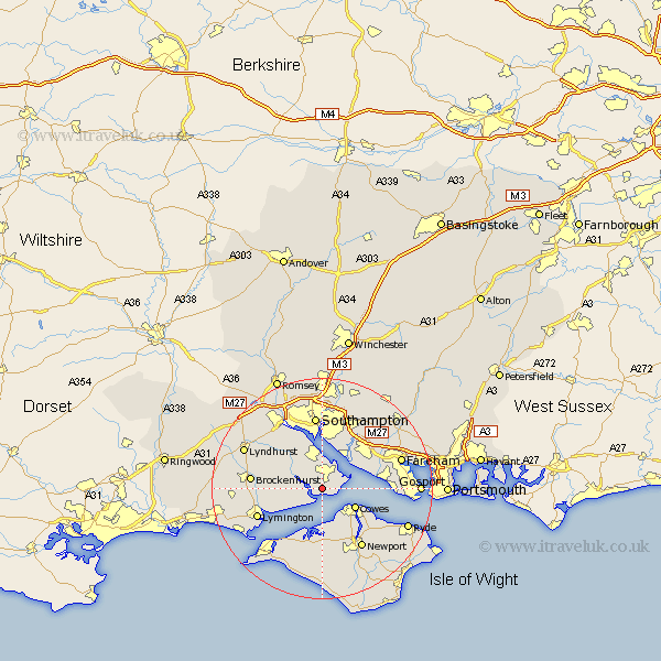
Hampshire Map Showing Location of Exbury
Population: 159
District: New Forest
Easting: 443452 Northing: 100292
Latitude: 50.8 Longitude: -1.38
 = Exbury
District: New Forest
Easting: 443452 Northing: 100292
Latitude: 50.8 Longitude: -1.38
= Exbury
This Exbury map below is supplied by Google. Use the tools in the top left corner to zoom into street level or zoom out for a road map, you may also need to zoom in to see Exbury on the map. Click and drag the map to move around. If the map fails to load try and refresh your browser or zoom in or out (+ or -).
Update - it seems Google no longer allow people to use their maps for free! This Exbury map sometimes loads and sometimes gives a error. I am working on a solution.
Closest 30 Towns or Cities to Exbury (Population over 500)
Fawley 2.99km Beaulieu 5.04km Bewley 5.04km Cowes 6.93km Hamble 7.27km Hample 7.27km Gurnard 7.27km Hythe 7.51km East Cowes 8.08km Dibden 8.21km Netley 8.21km Netley Marsh 8.21km Ashurst 8.48km Locks Heath 8.7km Northwood 8.77km Bursledon 9.45km Marchwood 9.91km Itchen 11.12km Boldre 11.18km Shalfleet 11.18km Lee-on-Solent 12.88km Lee on Solent 12.88km Lee on the Solent 12.88km Lee-on-the-Solent 12.88km Lymington 12.97km Brockenhurst 13.02km Eling 13.15km Newport 13.16km Southampton 13.39km West End 13.44km