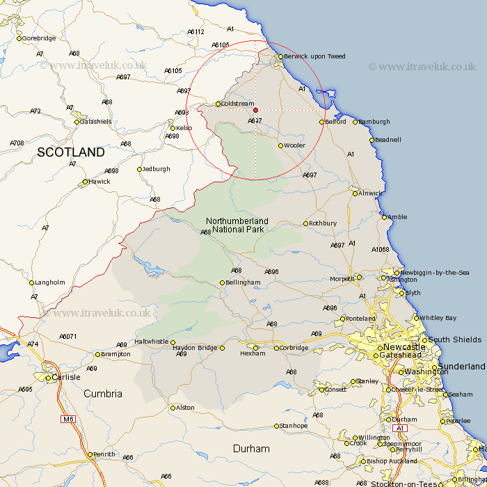
Northumberland Map Showing Location of Etal
District: Berwick-upon-Tweed
Easting: 393704 Northing: 637752
Latitude: 55.63 Longitude: -2.1
 = Etal
Easting: 393704 Northing: 637752
Latitude: 55.63 Longitude: -2.1
= Etal
This Etal map below is supplied by Google. Use the tools in the top left corner to zoom into street level or zoom out for a road map, you may also need to zoom in to see Etal on the map. Click and drag the map to move around. If the map fails to load try and refresh your browser or zoom in or out (+ or -).
Update - it seems Google no longer allow people to use their maps for free! This Etal map sometimes loads and sometimes gives a error. I am working on a solution.
Closest 30 Towns or Cities to Etal (Population over 500)
Lowick 8.37km Ancroft 9.71km Norham 9.79km Wooler 12.77km Ord 13.99km East Ord 13.99km Belford 17.15km Berwick-on-Tweed 17.82km Berwick-upon-Tweed 17.82km Berwick 17.82km Berwick on Tweed 17.82km Berwick-Upon-Tweed 17.82km Berwick upon Tweed 17.82km North Sunderland 28.21km Beadnell 30.75km Embleton 34.67km Alnwick 36.15km Almwick 36.15km Rothbury 37.39km Shilbottle 39.59km Alnmouth 40.79km Lisburg 41.22km Lesbury 41.22km Swarland 43.68km Longframlington 43.74km Warkworth 43.81km Felton 46.38km Otterburn 46.51km Amble 46.61km Thirston 46.95km