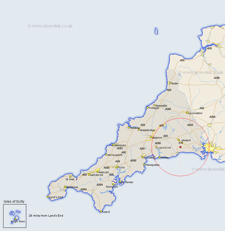
Cornwall Map Showing Location of East Looe
District: Caradon
Easting: 227087 Northing: 58466
Latitude: 50.4 Longitude: -4.43
 = East Looe
Easting: 227087 Northing: 58466
Latitude: 50.4 Longitude: -4.43
= East Looe
This East Looe map below is supplied by Google. Use the tools in the top left corner to zoom into street level or zoom out for a road map, you may also need to zoom in to see East Looe on the map. Click and drag the map to move around. If the map fails to load try and refresh your browser or zoom in or out (+ or -).
Update - it seems Google no longer allow people to use their maps for free! This East Looe map sometimes loads and sometimes gives a error. I am working on a solution.
Closest 30 Towns or Cities to East Looe (Population over 500)
Morval 2.2km Menheniot 3.89km Duloe 4km Looe 5.05km West Looe 5.05km Liskeard 5.68km Pelynt 8km Dobwalls 8.11km Lanreath 9.63km Lansallos 10.15km Sherviock 11.26km Sheviock 11.26km Callington 14.59km Lanteglos 14.97km Saltash 15.47km Linkinhorne 15.56km Fowey 16.01km Lostwithiel 16.54km North Hill 16.68km Torpoint 16.95km Cardingham 17.92km Cardinham 17.92km Millbrook 18.11km Tywardreath 18.58km Bere Alston 18.94km Calstock 18.94km St Blazey 20.08km St. Blazey 20.08km Saint Blazey 20.08km Par 20.85km