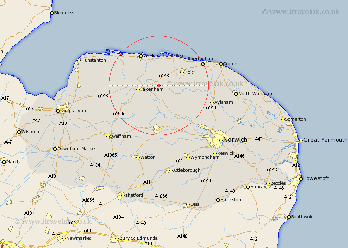
Norfolk Map Showing Location of Croxton
Population: 416
District: North Norfolk
Easting: 598618 Northing: 332168
Latitude: 52.85 Longitude: 0.95
 = Croxton
District: North Norfolk
Easting: 598618 Northing: 332168
Latitude: 52.85 Longitude: 0.95
= Croxton
This Croxton map below is supplied by Google. Use the tools in the top left corner to zoom into street level or zoom out for a road map, you may also need to zoom in to see Croxton on the map. Click and drag the map to move around. If the map fails to load try and refresh your browser or zoom in or out (+ or -).
Update - it seems Google no longer allow people to use their maps for free! This Croxton map sometimes loads and sometimes gives a error. I am working on a solution.
Closest 30 Towns or Cities to Croxton (Population over 500)
Little Snoring 3.36km Ryburgh 4.33km Great Ryburgh 4.33km Melton Constable 5.6km Mellon Constable 5.6km Little Walsingham 5.81km Walsingham 5.81km Hindolveston 5.81km Briston 7.83km Fakenham 8.05km Foulham 8.66km Foulsham 8.66km Colkirk 8.72km Sculthorpe 8.95km Holt 10.54km South Creake 12.85km Corpusty 12.86km North Elmham 12.98km Blakeney 13.4km Bawdeswell 14.13km Wells next the Sea 14.61km Wells on Sea 14.61km Wells-on-Sea 14.61km Wells 14.61km Wells-next-the-Sea 14.61km Mileham 14.62km Tattersett 14.67km Tatterset 14.67km Beetley 14.99km Syderstone 15.67km