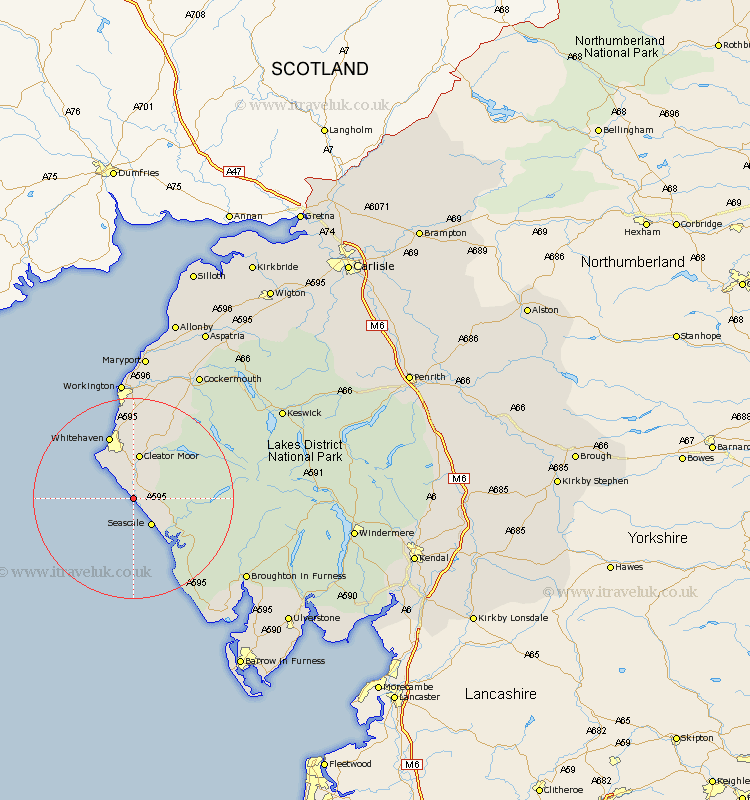
Cumbria Map Showing Location of Braystones
District: Copeland
Easting: 300551 Northing: 505306
Latitude: 54.43 Longitude: -3.53
 = Braystones
Easting: 300551 Northing: 505306
Latitude: 54.43 Longitude: -3.53
= Braystones
This Braystones map below is supplied by Google. Use the tools in the top left corner to zoom into street level or zoom out for a road map, you may also need to zoom in to see Braystones on the map. Click and drag the map to move around. If the map fails to load try and refresh your browser or zoom in or out (+ or -).
Update - it seems Google no longer allow people to use their maps for free! This Braystones map sometimes loads and sometimes gives a error. I am working on a solution.
Closest 30 Towns or Cities to Braystones (Population over 500)
Egremont 3.87km Seascale 6.43km Gosforth 7.45km Saint Bees 9.17km St. Bees 9.17km St Bees 9.17km St. Bega 9.17km Saint Bega 9.17km St Bega 9.17km Cleator Moor 9.34km Frizington 11.58km Whitehaven 13.67km Parton 15.18km Distington 16.68km Lowca 16.99km Lamplugh 17.15km Dean 19.63km Bootle 21.44km Workington 24.19km Brigham 25.24km Flimby 27.82km Broughton Moor 28.13km Cockermouth 28.52km Maryport 29.73km Bridekirk 29.8km Dearham 30.35km Conistan 31.1km Coniston 31.1km Millom 31.18km Keswick 32.66km