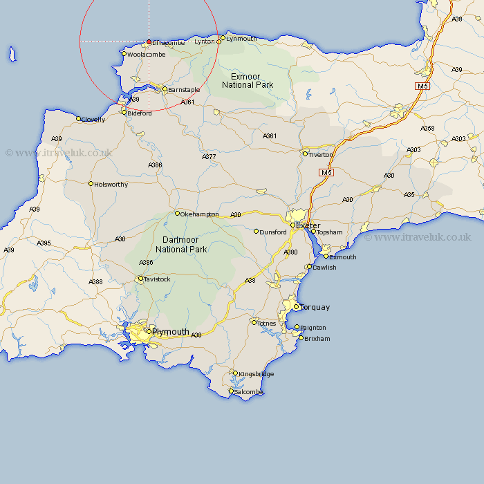
Devon Map Showing Location of Ilfracombe
Population: 11244
Area Size (ha): 241
District: North Devon
Easting: 252188 Northing: 148571
Latitude: 51.22 Longitude: -4.12
 = Ilfracombe
Area Size (ha): 241
District: North Devon
Easting: 252188 Northing: 148571
Latitude: 51.22 Longitude: -4.12
= Ilfracombe
This Ilfracombe map below is supplied by Google. Use the tools in the top left corner to zoom into street level or zoom out for a road map, you may also need to zoom in to see Ilfracombe on the map. Click and drag the map to move around. If the map fails to load try and refresh your browser or zoom in or out (+ or -).
Update - it seems Google no longer allow people to use their maps for free! This Ilfracombe map sometimes loads and sometimes gives a error. I am working on a solution.
Closest 30 Towns or Cities to Ilfracombe (Population over 500)
Berrynarbor 3.95km West Down 5.56km Combe Martin 6.09km Morthoe 6.89km Mortehoe 6.89km Georgeham 10.94km Marwood 11.36km Braunton 13.78km Barnstaple 15.54km Bratton Fleming 16.08km Fremington 16.68km Instow 18.86km Tawstock 19.11km Appledore 19.42km Lynton 19.73km Linton 19.73km Swimbridge 21.28km Northam 21.55km Bideford 23.31km Chittlehampton 25.09km North Molton 28.84km High Bickington 28.96km Buckland Brewer 29.31km Great Torrington 29.74km Torrington 29.74km South Molton 29.76km Parkham 30.6km Woolsery 33.46km Woolfardisworthy 33.46km Burrington 33.59km