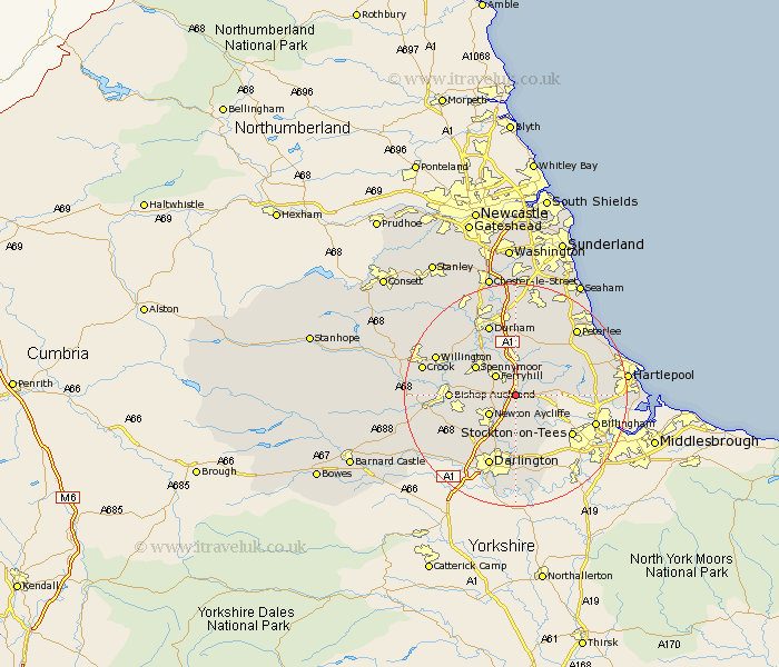
Durham Map Showing Location of Bradbury
Population: 141
District: Sedgefield
Easting: 432258 Northing: 528449
Latitude: 54.65 Longitude: -1.5
 = Bradbury
District: Sedgefield
Easting: 432258 Northing: 528449
Latitude: 54.65 Longitude: -1.5
= Bradbury
This Bradbury map below is supplied by Google. Use the tools in the top left corner to zoom into street level or zoom out for a road map, you may also need to zoom in to see Bradbury on the map. Click and drag the map to move around. If the map fails to load try and refresh your browser or zoom in or out (+ or -).
Update - it seems Google no longer allow people to use their maps for free! This Bradbury map sometimes loads and sometimes gives a error. I am working on a solution.
Closest 30 Towns or Cities to Bradbury (Population over 500)
Bishop Middleham 3.86km Sedgefield 4.29km Ferryhill 4.91km Cornforth 5.66km West Cornforth 5.66km Fishburn 5.67km Newton Aycliffe 5.67km Stillington 7.02km Coxhoe 7.42km Trimdon 7.72km Grindon 8.37km Spennymoor 8.45km Bowburn 9.33km Carlton 9.82km Coundon 9.83km Shildon 9.83km Bishop Auckland 10.72km Stockton 11.84km Stockton on Tees 11.84km Stockton-on-Tees 11.84km Thornley 11.92km Wingate 11.92km Hutton Henry 12.16km Sherburn 13.02km Shincliffe 13.15km Brandon 13.41km Durham 13.66km Darlington 13.67km Billingham-on-Tees 14.02km Billingham 14.02km