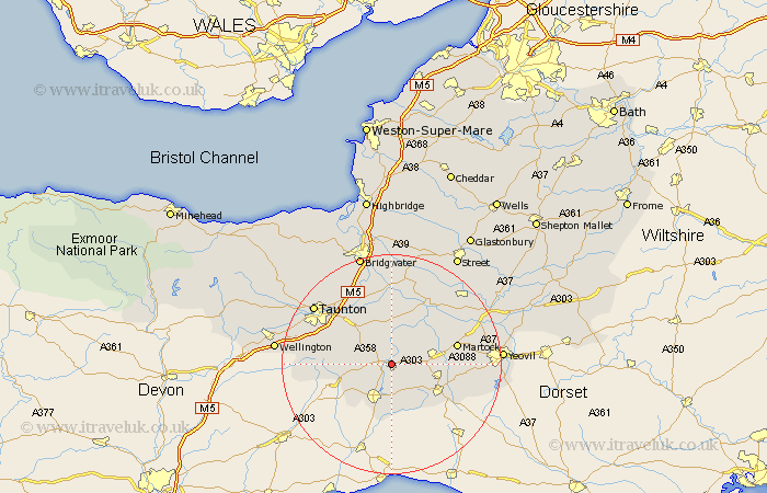
Somerset Map Showing Location of Ilminster
Population: 4059
Area Size (ha): 101
District: South Somerset
Easting: 335592 Northing: 115333
Latitude: 50.93 Longitude: -2.92
 = Ilminster
Area Size (ha): 101
District: South Somerset
Easting: 335592 Northing: 115333
Latitude: 50.93 Longitude: -2.92
= Ilminster
This Ilminster map below is supplied by Google. Use the tools in the top left corner to zoom into street level or zoom out for a road map, you may also need to zoom in to see Ilminster on the map. Click and drag the map to move around. If the map fails to load try and refresh your browser or zoom in or out (+ or -).
Update - it seems Google no longer allow people to use their maps for free! This Ilminster map sometimes loads and sometimes gives a error. I am working on a solution.
Closest 30 Towns or Cities to Ilminster (Population over 500)
Ilton 1.86km Broadway 3.5km Combe St Nicholas 6.92km Combe Saint Nicholas 6.92km Combe St. Nicholas 6.92km Fivehead 7.42km Hatch Beauchamp 8.06km Chard 8.19km South Petherton 8.38km Winsham 9.34km Curry Rivel 9.56km Kingsbury 9.88km Kingsbury Episcopi 9.88km Crewkerne 9.89km North Curry 9.91km Misterton 11.04km Stoke St. Gregory 11.18km Stoke Saint Gregory 11.18km Stoke St Gregory 11.18km Creech Saint Michael 11.62km Creech St Michael 11.62km Creech St. Michael 11.62km West Chinnock 11.83km Martock 12.25km Haselbury Plucknett 12.26km Langport 12.56km Long Sutton 14.01km Montacute 14.14km Tintinhull 14.49km Pitminster 14.49km