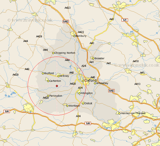
Oxfordshire Map Showing Location of Aston
District: West Oxfordshire
Easting: 434538 Northing: 202166
Latitude: 51.72 Longitude: -1.5
 = Aston
Easting: 434538 Northing: 202166
Latitude: 51.72 Longitude: -1.5
= Aston
This Aston map below is supplied by Google. Use the tools in the top left corner to zoom into street level or zoom out for a road map, you may also need to zoom in to see Aston on the map. Click and drag the map to move around. If the map fails to load try and refresh your browser or zoom in or out (+ or -).
Update - it seems Google no longer allow people to use their maps for free! This Aston map sometimes loads and sometimes gives a error. I am working on a solution.
Closest 30 Towns or Cities to Aston (Population over 500)
Bampton 2.3km Ducklington 3.88km Buckland 5.56km Standlake 5.74km Longworth 5.91km Clanfield 6.04km Carterton 6.83km Stanton Harcourt 7.13km Brize Norton 7.21km Witney 7.49km Kingston Bagpuize 7.99km Kingston Bagpuze 7.99km Shilton 8.85km Stanford in the Vale 9.27km Hailey 9.33km Faringdon 9.38km Minster Lovell 9.54km Ensham 9.77km Eynsham 9.77km North Leigh 10.34km Leafield 11.35km Cumnor 11.48km Hanborough 12.26km Church Handborough 12.26km Cassington 12.71km Burford 13.04km East Hanney 13.08km Hanney 13.08km Marcham 13.68km Stonesfield 13.75km