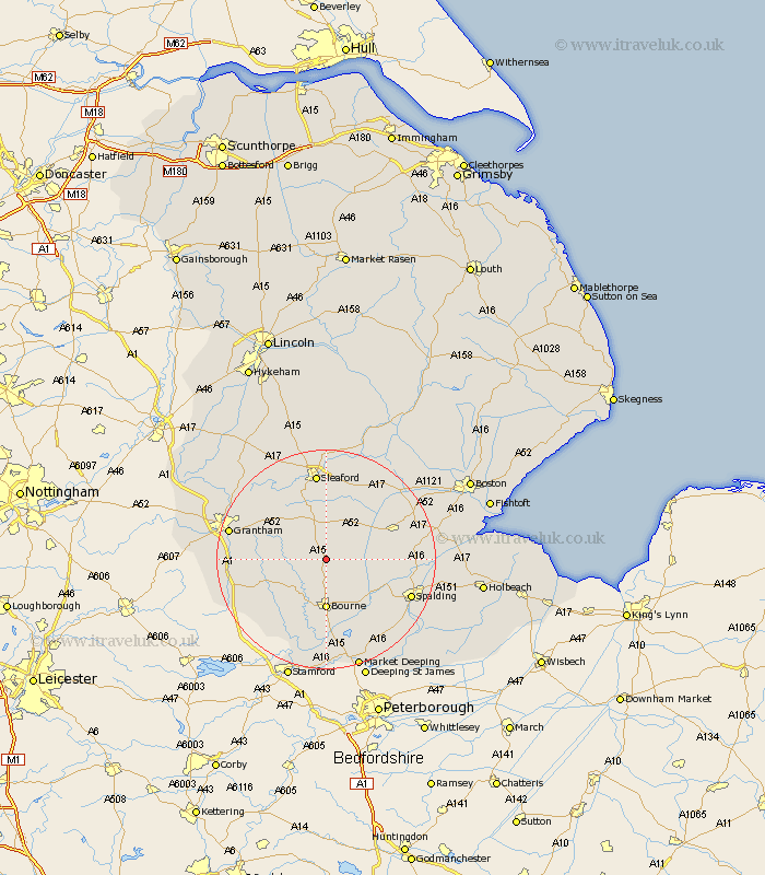
Lincolnshire Map Showing Location of Aslackby
Population: 243
District: South Kesteven
Easting: 508856 Northing: 329315
Latitude: 52.85 Longitude: -0.38
 = Aslackby
District: South Kesteven
Easting: 508856 Northing: 329315
Latitude: 52.85 Longitude: -0.38
= Aslackby
This Aslackby map below is supplied by Google. Use the tools in the top left corner to zoom into street level or zoom out for a road map, you may also need to zoom in to see Aslackby on the map. Click and drag the map to move around. If the map fails to load try and refresh your browser or zoom in or out (+ or -).
Update - it seems Google no longer allow people to use their maps for free! This Aslackby map sometimes loads and sometimes gives a error. I am working on a solution.
Closest 30 Towns or Cities to Aslackby (Population over 500)
Folkingham 2.17km Pointon 3.36km Rippingale 3.87km Billingborough 5km Morton 7.5km Bourn 9.26km Bourne 9.26km Ropsley 9.69km Corby 10.54km Helpringham 10.82km Hale 12.99km Great Hale 12.99km Donington 13.5km Heckington 14.61km Quadring 14.66km Thurlby 14.86km Gosberton 15.67km Sleaford 16.04km Bicker 16.32km Spalding 16.34km Ancaster 16.42km Castle Bytham 16.43km Colsterworth 16.63km Pinchbeck 16.63km Baston 16.83km Surfleet 16.89km Langtoft 17.01km Langfoft 17.01km Belton 17.24km Grantham 17.68km