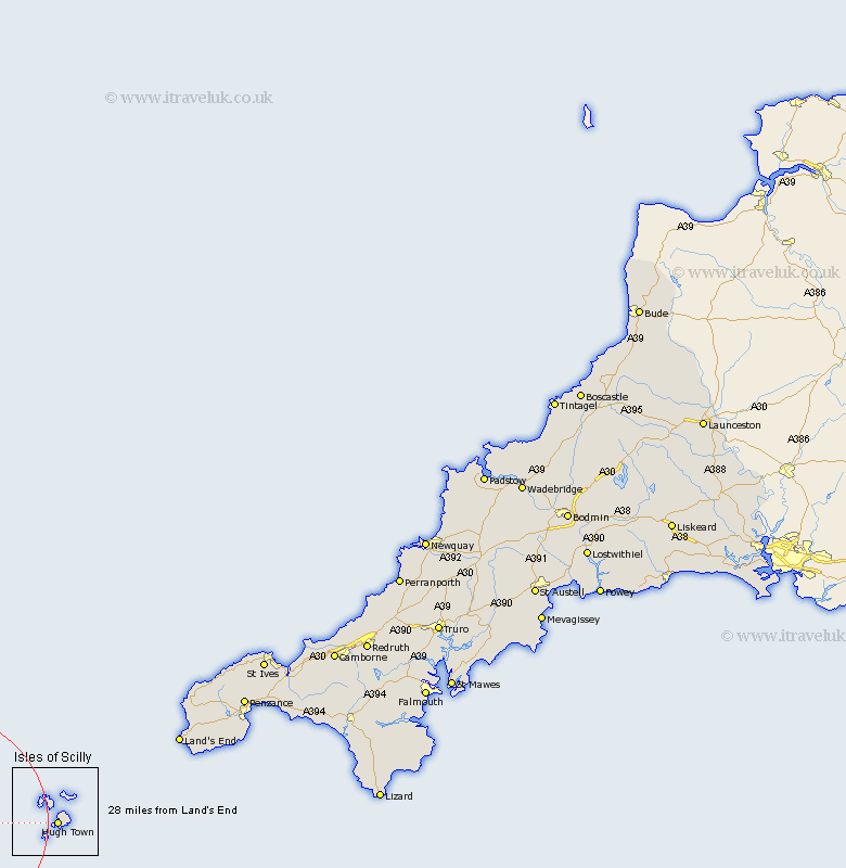
Cornwall Map Showing Location of Isles Of Scilly
District: Isles of Scilly
Easting: 88986 Northing: 10907
Latitude: 49.92 Longitude: -6.33
 = Isles Of Scilly
Easting: 88986 Northing: 10907
Latitude: 49.92 Longitude: -6.33
= Isles Of Scilly
This Isles Of Scilly map below is supplied by Google. Use the tools in the top left corner to zoom into street level or zoom out for a road map, you may also need to zoom in to see Isles Of Scilly on the map. Click and drag the map to move around. If the map fails to load try and refresh your browser or zoom in or out (+ or -).
Update - it seems Google no longer allow people to use their maps for free! This Isles Of Scilly map sometimes loads and sometimes gives a error. I am working on a solution.
Closest 30 Towns or Cities to Isles Of Scilly (Population over 500)
Sennan 48.25km Sennen 48.25km St. Just 50.42km Saint Just 50.42km St Just 50.42km St. Burian 53.88km St. Buryan 53.88km St Burian 53.88km Saint Buryan 53.88km Saint Burian 53.88km St Buryan 53.88km Sancreed 56.23km Madron 59.83km Penzance 60.92km Ludgvan 65.32km St. Eval 65.6km St Eval 65.6km Saint Eval 65.6km Marazion 66.43km Perranuthnoe 66.92km Saint Ives 67.32km St Ives 67.32km St. Ives 67.32km Saint Hilary 69.17km St. Hilary 69.17km St Hilary 69.17km Germoe 71.43km Germol 71.43km Hayle 74.03km Heyl 74.03km