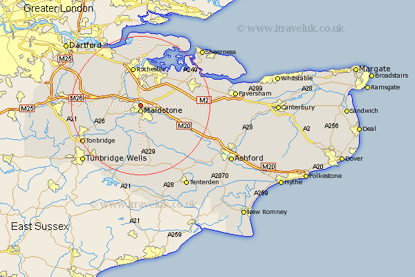
Kent Map Showing Location of Allington
District: Maidstone
Easting: 575486 Northing: 156860
Latitude: 51.28 Longitude: 0.52
 = Allington
Easting: 575486 Northing: 156860
Latitude: 51.28 Longitude: 0.52
= Allington
This Allington map below is supplied by Google. Use the tools in the top left corner to zoom into street level or zoom out for a road map, you may also need to zoom in to see Allington on the map. Click and drag the map to move around. If the map fails to load try and refresh your browser or zoom in or out (+ or -).
Update - it seems Google no longer allow people to use their maps for free! This Allington map sometimes loads and sometimes gives a error. I am working on a solution.
Closest 30 Towns or Cities to Allington (Population over 500)
Maidstone 1.85km Boxley 2.32km Aylesford 2.32km Bearsted 3.94km Burham 4.38km Detling 4.64km East Barming 5.08km Barming 5.08km Loose 5.56km East Malling 6.08km Wouldham 6.56km Snodland 6.88km Langley 7.24km Linton 7.41km Boughton Monchelsea 7.5km Wateringbury 7.88km West Malling 8.11km Addington 8.11km Cuxton 8.74km Leeds 8.91km Yalding 9.41km Ryarsh 9.46km Hunton 9.55km Stockbury 9.99km Hollingbourne 9.99km Sutton Valence 10.36km Offham 10.43km Mereworth 11.07km Chatham 11.12km Strood 11.18km