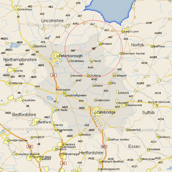
Cambridgeshire Map Showing Location of Wisbech St Mary
District: Fenland
Easting: 542100 Northing: 306058
Latitude: 52.63 Longitude: 0.1
 = Wisbech St Mary
Easting: 542100 Northing: 306058
Latitude: 52.63 Longitude: 0.1
= Wisbech St Mary
This Wisbech St Mary map below is supplied by Google. Use the tools in the top left corner to zoom into street level or zoom out for a road map, you may also need to zoom in to see Wisbech St Mary on the map. Click and drag the map to move around. If the map fails to load try and refresh your browser or zoom in or out (+ or -).
Update - it seems Google no longer allow people to use their maps for free! This Wisbech St Mary map sometimes loads and sometimes gives a error. I am working on a solution.
Closest 30 Towns or Cities to Wisbech St Mary (Population over 500)
Elm 5.62km Wisbech 5.83km Newton 7.75km March 9.33km Thorney 13.62km Wimblington 14.99km Doddington 16.83km Manea 17.6km Whittlesey 18.28km Eye 19.48km Chatteris 20.66km Newborough 21.45km Peterbrough 24.28km Peterborough 24.28km Petersborough 24.28km Downham 24.44km Littleport 24.46km Ramsey 25.1km Farcet 25.12km Glinton 25.87km Northborough 25.93km Mepal 25.97km Bury 27.63km Sutton 27.8km Yaxley 27.92km Warboys 28.29km Ely 28.29km Orton Waterville 28.56km Somersham 28.61km Witchford 28.61km