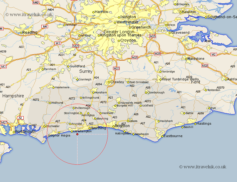
Sussex Map Showing Location of West Preston
District: Arun
Easting: 506906 Northing: 99351
Latitude: 50.78 Longitude: -0.48
 = West Preston
Easting: 506906 Northing: 99351
Latitude: 50.78 Longitude: -0.48
= West Preston
This West Preston map below is supplied by Google. Use the tools in the top left corner to zoom into street level or zoom out for a road map, you may also need to zoom in to see West Preston on the map. Click and drag the map to move around. If the map fails to load try and refresh your browser or zoom in or out (+ or -).
Update - it seems Google no longer allow people to use their maps for free! This West Preston map sometimes loads and sometimes gives a error. I am working on a solution.
Closest 30 Towns or Cities to West Preston (Population over 500)
Preston 1.17km East Preston 1.17km Rustington 2.2km Kingston 2.34km Ferring 2.99km West Ferring 2.99km Angmering 3.71km Littlehampton 3.97km Ford 7.95km Yapton 8.41km Arundel 8.77km Worthing 9.16km Middleton-on-Sea 9.37km Middleton on Sea 9.37km Middleton 9.37km Findon 9.45km Sompting 10.08km Lancing 11.18km North Lancing 11.18km Barnham 11.18km Westergate 11.47km Bognor 11.72km Felpham 11.72km Bognor Regis 11.77km Walberton 11.95km Slindon 12.89km Eastergate 12.96km Bersted 14.06km Washington 14.23km Bury 14.23km