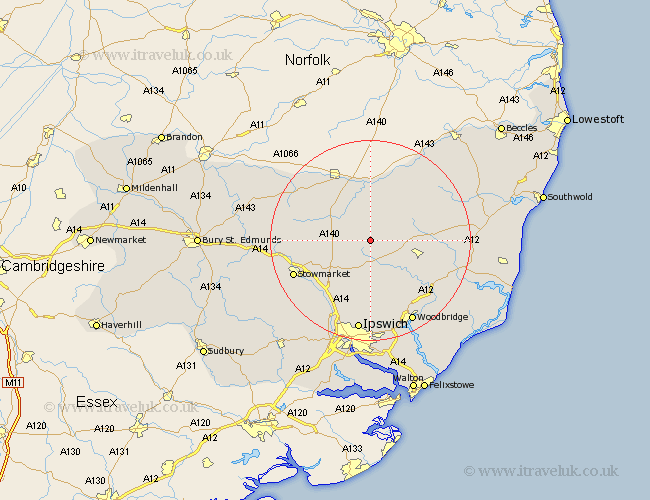
Suffolk Map Showing Location of Kenton
Population: 165
District: Mid Suffolk
Easting: 618406 Northing: 266182
Latitude: 52.25 Longitude: 1.2
 = Kenton
District: Mid Suffolk
Easting: 618406 Northing: 266182
Latitude: 52.25 Longitude: 1.2
= Kenton
This Kenton map below is supplied by Google. Use the tools in the top left corner to zoom into street level or zoom out for a road map, you may also need to zoom in to see Kenton on the map. Click and drag the map to move around. If the map fails to load try and refresh your browser or zoom in or out (+ or -).
Update - it seems Google no longer allow people to use their maps for free! This Kenton map sometimes loads and sometimes gives a error. I am working on a solution.
Closest 30 Towns or Cities to Kenton (Population over 500)
Debenham 3.87km Worlingworth 3.88km Thorndon 5.86km Dennington 7.06km Eye 8.16km Stradbroke 8.69km Mendlesham 9.08km Framlingham 9.81km Hoxne 11.12km Otley 11.35km Gislingham 11.62km Bacton 12.62km Laxfield 12.63km Old Newton 13.02km Fressingfield 13.03km Coddenham 14.17km Wortham 15.09km Henley 15.21km Haughley 15.21km Botesdale 15.53km Wickham Market 15.9km Stowmarket 16.52km Wirnesham 16.72km Witnesham 16.72km Grundisburgh 17.02km Ufford 18.01km Great Blakenham 18.02km Woodbridge 18.48km Melton 18.48km Cookley 18.55km