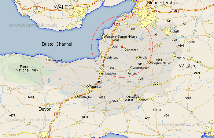
Somerset Map Showing Location of Axbridge
Population: 2025
District: Sedgemoor
Easting: 344212 Northing: 154159
Latitude: 51.28 Longitude: -2.8
 = Axbridge
District: Sedgemoor
Easting: 344212 Northing: 154159
Latitude: 51.28 Longitude: -2.8
= Axbridge
This Axbridge map below is supplied by Google. Use the tools in the top left corner to zoom into street level or zoom out for a road map, you may also need to zoom in to see Axbridge on the map. Click and drag the map to move around. If the map fails to load try and refresh your browser or zoom in or out (+ or -).
Update - it seems Google no longer allow people to use their maps for free! This Axbridge map sometimes loads and sometimes gives a error. I am working on a solution.
Closest 30 Towns or Cities to Axbridge (Population over 500)
Axbridge 0km Shipham 1.85km Cheddar 2.97km Weare 2.97km Priddy 4.37km Churchill 5.56km Banwell 5.94km Rodney Stoke 5.94km Sandford 6.02km Wedmore 7.5km Blagdon 8.03km Locking 8.03km Westbury 8.04km Congresbury 9.27km Wrington 9.56km Hutton 9.98km Mark 10.16km Lympsham 10.43km Bleadon 10.59km Compton Martin 10.59km Yatton 11.18km East Harptree 11.74km Brent Knoll 12.17km Wookey 12.32km Wells 12.8km Meare 13.02km Chew Stoke 13.75km Wick St Lawrence 13.76km Wick St. Lawrence 13.76km Wick Saint Lawrence 13.76km