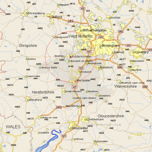
Worcestershire Map Showing Location of Kidderminster
Population: 54092
Area Size (ha): 1481
District: Wyre Forest
Easting: 382985 Northing: 276212
Latitude: 52.38 Longitude: -2.25
 = Kidderminster
Area Size (ha): 1481
District: Wyre Forest
Easting: 382985 Northing: 276212
Latitude: 52.38 Longitude: -2.25
= Kidderminster
This Kidderminster map below is supplied by Google. Use the tools in the top left corner to zoom into street level or zoom out for a road map, you may also need to zoom in to see Kidderminster on the map. Click and drag the map to move around. If the map fails to load try and refresh your browser or zoom in or out (+ or -).
Update - it seems Google no longer allow people to use their maps for free! This Kidderminster map sometimes loads and sometimes gives a error. I am working on a solution.
Closest 30 Towns or Cities to Kidderminster (Population over 500)
Stone 3.86km Stourport 3.87km Stourport on Severn 3.87km Stourport-on-Severn 3.87km Bewdley 4.52km Hartlebury 5.67km Churchill 5.85km Chaddesley Corbett 6.76km Upper Arley 8.77km Arley 8.77km Belbroughton 9.24km Clent 9.78km Astley 10.31km Hagley 10.62km Dodford 10.84km Great Dodford 10.84km Rock 11.6km Stourbridge 12.19km Abberley 12.19km Ombersley 13.02km Great Witley 13.03km Bromsgrove 13.64km Lickey End 13.7km Lickey 13.7km Romsley 14.07km Droitwich 14.64km Holt 14.82km Halesowen 15.46km Stoke Prior 15.52km Netherton 15.85km