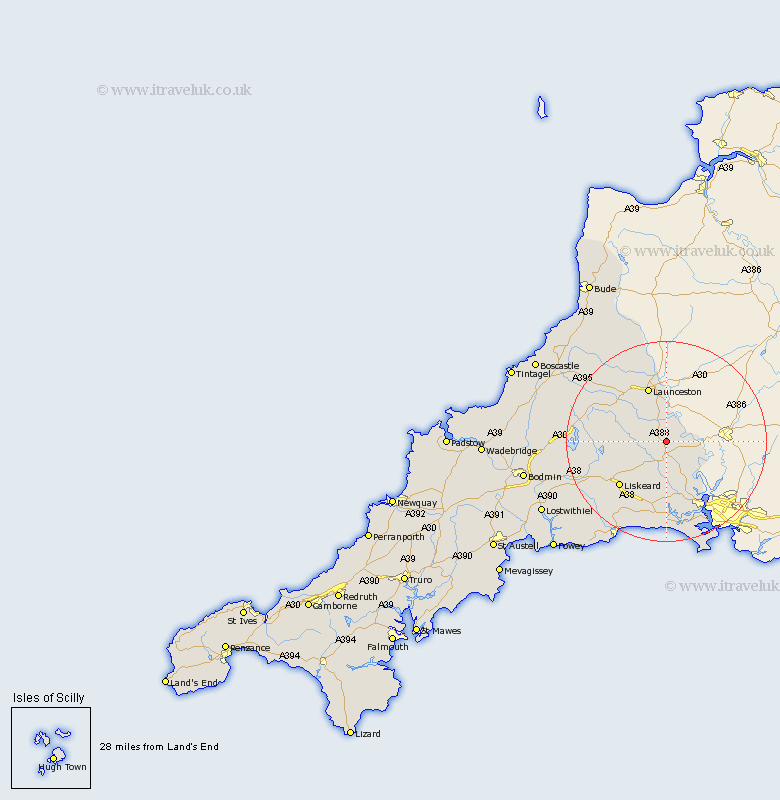
Cornwall Map Showing Location of Stoke Climsland
District: Caradon
Easting: 235839 Northing: 73020
Latitude: 50.53 Longitude: -4.32
 = Stoke Climsland
Easting: 235839 Northing: 73020
Latitude: 50.53 Longitude: -4.32
= Stoke Climsland
This Stoke Climsland map below is supplied by Google. Use the tools in the top left corner to zoom into street level or zoom out for a road map, you may also need to zoom in to see Stoke Climsland on the map. Click and drag the map to move around. If the map fails to load try and refresh your browser or zoom in or out (+ or -).
Update - it seems Google no longer allow people to use their maps for free! This Stoke Climsland map sometimes loads and sometimes gives a error. I am working on a solution.
Closest 30 Towns or Cities to Stoke Climsland (Population over 500)
Linkinhorne 3.53km Callington 3.89km Lezant 6.04km North Hill 8.45km Calstock 9.95km Bere Alston 9.95km South Petherwin 10.4km Lewannick 11.09km Launceston 11.67km Menheniot 13.18km Liskeard 13.22km Saltash 14.77km Dobwalls 16.91km Altarnun 17.01km North Petherwin 18.6km Sherviock 18.68km Sheviock 18.68km Morval 19.16km Torpoint 20.28km Duloe 20.43km Millbrook 20.79km Looe 21.9km West Looe 21.9km Pelynt 24.05km Cardingham 24.22km Cardinham 24.22km Lanreath 24.32km Lansallos 25.62km Blisland 25.99km Camelford 27.5km