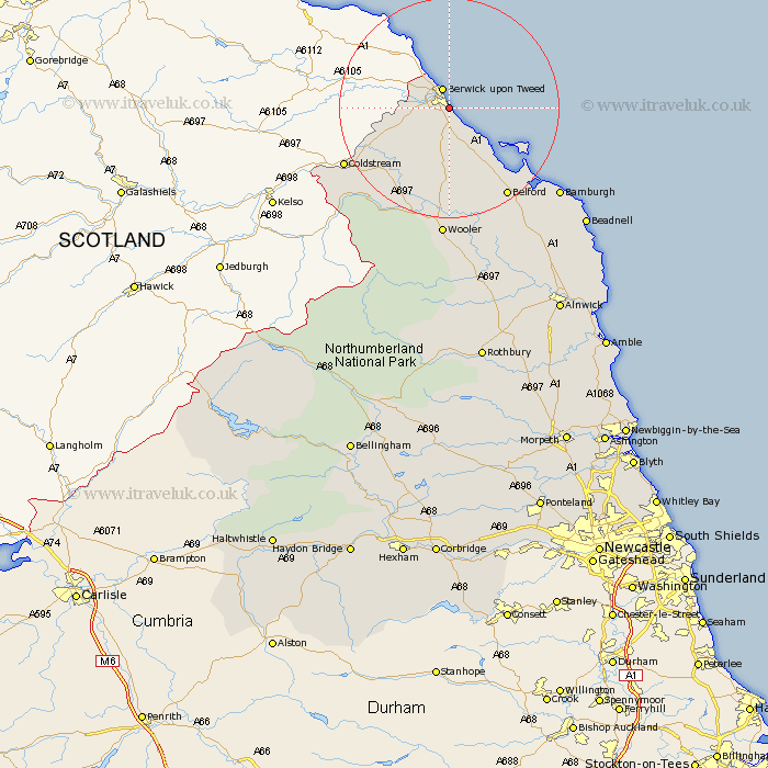
Northumberland Map Showing Location of Spittal
District: Berwick-upon-Tweed
Easting: 401046 Northing: 650734
Latitude: 55.75 Longitude: -1.98
 = Spittal
Easting: 401046 Northing: 650734
Latitude: 55.75 Longitude: -1.98
= Spittal
This Spittal map below is supplied by Google. Use the tools in the top left corner to zoom into street level or zoom out for a road map, you may also need to zoom in to see Spittal on the map. Click and drag the map to move around. If the map fails to load try and refresh your browser or zoom in or out (+ or -).
Update - it seems Google no longer allow people to use their maps for free! This Spittal map sometimes loads and sometimes gives a error. I am working on a solution.
Closest 30 Towns or Cities to Spittal (Population over 500)
East Ord 2.09km Ord 2.09km Berwick-on-Tweed 3.85km Berwick-upon-Tweed 3.85km Berwick 3.85km Berwick on Tweed 3.85km Berwick-Upon-Tweed 3.85km Berwick upon Tweed 3.85km Ancroft 5.66km Norham 11.07km Lowick 13.02km Belford 19.15km Wooler 24.11km North Sunderland 28.46km Beadnell 31.25km Embleton 37.54km Alnwick 42.8km Almwick 42.8km Alnmouth 45.77km Shilbottle 46.61km Lesbury 46.84km Lisburg 46.84km Rothbury 48.46km Warkworth 50.1km Swarland 52.45km Amble 52.73km Longframlington 53.4km Felton 54.87km Thirston 55.22km East Thirston 55.22km