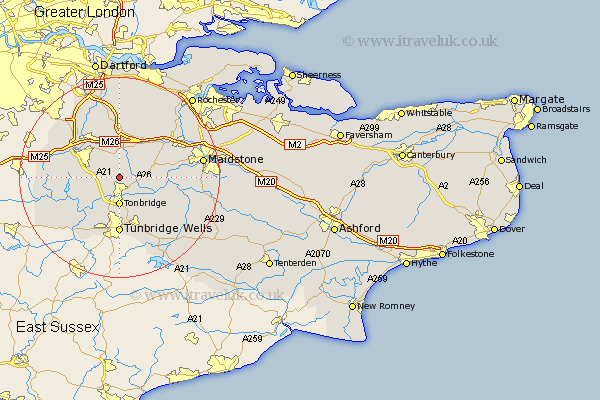
Kent Map Showing Location of Shipborne
District: Tonbridge and Malling
Easting: 559391 Northing: 150769
Latitude: 51.23 Longitude: 0.28
 = Shipborne
Easting: 559391 Northing: 150769
Latitude: 51.23 Longitude: 0.28
= Shipborne
This Shipborne map below is supplied by Google. Use the tools in the top left corner to zoom into street level or zoom out for a road map, you may also need to zoom in to see Shipborne on the map. Click and drag the map to move around. If the map fails to load try and refresh your browser or zoom in or out (+ or -).
Update - it seems Google no longer allow people to use their maps for free! This Shipborne map sometimes loads and sometimes gives a error. I am working on a solution.
Closest 30 Towns or Cities to Shipborne (Population over 500)
Plaxtol 2.19km Hadlow 3.94km Hildenborough 5.08km Tonbridge 5.56km Borough Green 5.68km Mereworth 6.09km Sevenoaks 6.89km Weald 7.2km Seal 7.24km Leigh 7.24km Wrotham 7.77km East Peckham 7.89km Offham 8.03km Kemsing 8.19km Wateringbury 9.47km Addington 9.84km West Malling 9.84km Southborough 9.9km Bidborough 9.9km Penshurst 10.17km Paddock Wood 10.17km Ryarsh 10.17km Otford 10.17km Ide Hill 10.44km Yalding 10.61km East Malling 11.08km Tunbridge Wells 11.12km Turnbridge Wells 11.12km Royal Tunbridge Wells 11.12km Ridley 11.36km