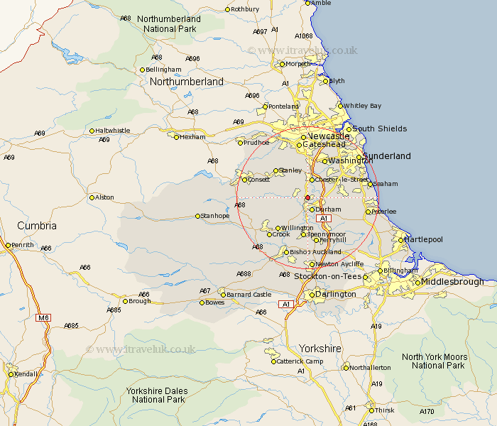
Durham Map Showing Location of Sheepscar
District: Durham
Easting: 426783 Northing: 545103
Latitude: 54.8 Longitude: -1.58
 = Sheepscar
Easting: 426783 Northing: 545103
Latitude: 54.8 Longitude: -1.58
= Sheepscar
This Sheepscar map below is supplied by Google. Use the tools in the top left corner to zoom into street level or zoom out for a road map, you may also need to zoom in to see Sheepscar on the map. Click and drag the map to move around. If the map fails to load try and refresh your browser or zoom in or out (+ or -).
Update - it seems Google no longer allow people to use their maps for free! This Sheepscar map sometimes loads and sometimes gives a error. I am working on a solution.
Closest 30 Towns or Cities to Sheepscar (Population over 500)
Sacriston 2.83km Witton Gilbert 3.2km Durham 3.85km Ushaw Moor 4.66km Shincliffe 4.9km Langley Park 5.34km West Rainton 5.65km Chester-le-Street 5.66km Brandon 5.96km Pittington 6.41km Edmondsley 6.42km Sherburn 7.4km Pelton 7.49km Esh 7.71km Bowburn 8.56km Hetton le Hole 8.74km Houghton le Spring 9.31km Birtley 9.32km Lanchester 9.79km Ouston Moor 10.05km Ouston 10.05km Coxhoe 10.69km Murton 10.84km Haswell 10.84km Annfield Plain 11.1km Thornley 11.11km Spennymoor 11.25km Stanley 11.49km South Hetton 11.75km Cornsay 11.9km