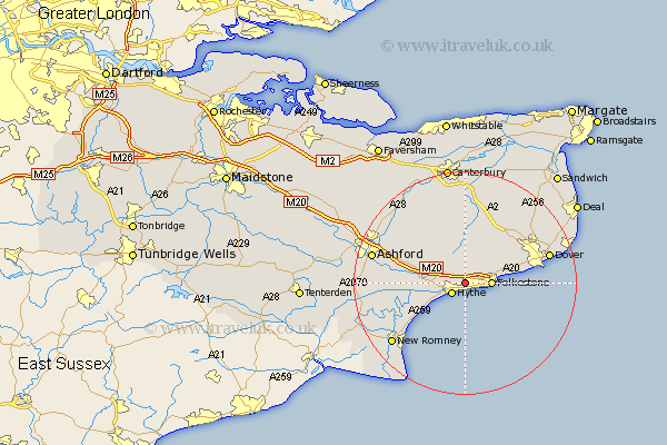
Kent Map Showing Location of Seabrook
District: Shepway
Easting: 618260 Northing: 136233
Latitude: 51.08 Longitude: 1.12
 = Seabrook
Easting: 618260 Northing: 136233
Latitude: 51.08 Longitude: 1.12
= Seabrook
This Seabrook map below is supplied by Google. Use the tools in the top left corner to zoom into street level or zoom out for a road map, you may also need to zoom in to see Seabrook on the map. Click and drag the map to move around. If the map fails to load try and refresh your browser or zoom in or out (+ or -).
Update - it seems Google no longer allow people to use their maps for free! This Seabrook map sometimes loads and sometimes gives a error. I am working on a solution.
Closest 30 Towns or Cities to Seabrook (Population over 500)
Hythe 2.97km Hawkinge 3.95km Lyminge 4.38km Folkstone 4.66km Folkestone 4.66km Lympne 6.11km Swingfield 7.25km Elham 7.42km Sellinge 8.36km Sellindge 8.36km Alkham 9.86km Brabourne 9.86km Dymchurch 11.02km Smeeth 11.11km Aldington 11.64km Stelling 11.65km River 11.86km Lydden 11.9km Temple Ewell 12.83km Ewell 12.83km Mersham 12.94km Coldred 13.14km Sibertswold 13.78km Shepherdswell 13.78km Hinxhill 13.96km Petham 15.54km Saint Margarets 15.81km Saint Margaret's at Cliffe 15.81km St. Margaret's at Cliffe 15.81km St Margarets 15.81km