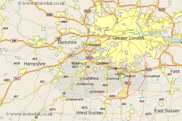
Surrey Map Showing Location of Kingswood
District: Reigate and Banstead
Easting: 522031 Northing: 155306
Latitude: 51.28 Longitude: -0.25
 = Kingswood
Easting: 522031 Northing: 155306
Latitude: 51.28 Longitude: -0.25
= Kingswood
This Kingswood map below is supplied by Google. Use the tools in the top left corner to zoom into street level or zoom out for a road map, you may also need to zoom in to see Kingswood on the map. Click and drag the map to move around. If the map fails to load try and refresh your browser or zoom in or out (+ or -).
Update - it seems Google no longer allow people to use their maps for free! This Kingswood map sometimes loads and sometimes gives a error. I am working on a solution.
Closest 30 Towns or Cities to Kingswood (Population over 500)
Tadworth 1.16km Leatherhead 4.64km Betchworth 5.56km Buckland 5.56km Mickleham 5.93km Reigate 6.02km Banstead 6.88km Oxshott 7.88km Redhill 8.03km Leigh 9.33km Dorking 9.41km Westcott 10.16km Claygate 10.16km Salfords 10.93km Esher 10.99km Effingham 11.07km Caterham 11.74km Bletchingley 11.83km Nutfield 11.87km Holmwood 12.05km Whyteleafe 12.17km Church Cobham 12.17km Cobham 12.17km Wotton 13.11km Horsley 13.28km East Horsley 13.28km Godstone 13.92km Warlingham 14.03km West Horsley 14.03km Horley 14.21km