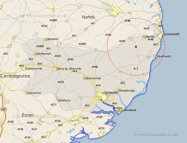
Suffolk Map Showing Location of Saint Lawrence
District: Waveney
Easting: 636935 Northing: 283749
Latitude: 52.4 Longitude: 1.48
 = Saint Lawrence
Easting: 636935 Northing: 283749
Latitude: 52.4 Longitude: 1.48
= Saint Lawrence
This Saint Lawrence map below is supplied by Google. Use the tools in the top left corner to zoom into street level or zoom out for a road map, you may also need to zoom in to see Saint Lawrence on the map. Click and drag the map to move around. If the map fails to load try and refresh your browser or zoom in or out (+ or -).
Update - it seems Google no longer allow people to use their maps for free! This Saint Lawrence map sometimes loads and sometimes gives a error. I am working on a solution.
Closest 30 Towns or Cities to Saint Lawrence (Population over 500)
Halesworth 5.67km Bungay 6km Holton 7.75km Worlingham 8.77km Beccles 9.32km Cookley 9.54km Wenhaston 10.31km Wangford 10.62km Reydon 13.63km Fressingfield 13.63km Laxfield 13.65km Wrentham 13.7km Yoxford 14.99km Southwold 15.47km Carlton Colville 15.71km Kessingland 15.94km Gisleham 16.25km Stradbroke 17.39km Oulton 19.31km Dennington 19.36km Hoxne 20.02km Lowestoft 20.31km Saxmundham 20.41km Worlingworth 21.7km Framlingham 22.79km Leiston 22.95km Corton 23.17km Snape 24.12km Eye 24.46km Thorndon 27.09km