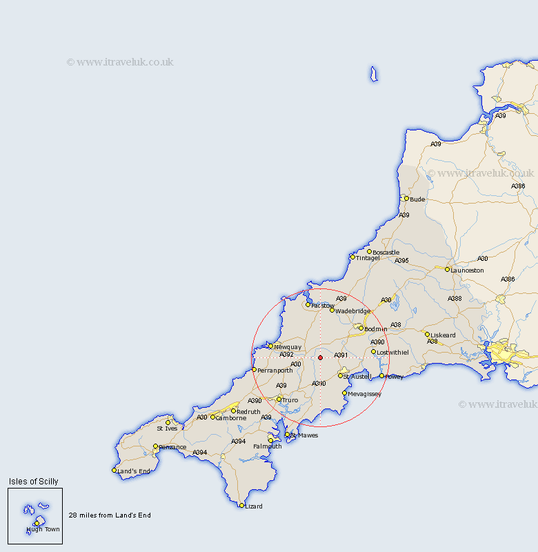
Cornwall Map Showing Location of St Dennis
Population: 1956
Area Size (ha): 43
District: Restormel
Easting: 195043 Northing: 57754
Latitude: 50.38 Longitude: -4.88
 = St Dennis
Area Size (ha): 43
District: Restormel
Easting: 195043 Northing: 57754
Latitude: 50.38 Longitude: -4.88
= St Dennis
This St Dennis map below is supplied by Google. Use the tools in the top left corner to zoom into street level or zoom out for a road map, you may also need to zoom in to see St Dennis on the map. Click and drag the map to move around. If the map fails to load try and refresh your browser or zoom in or out (+ or -).
Update - it seems Google no longer allow people to use their maps for free! This St Dennis map sometimes loads and sometimes gives a error. I am working on a solution.
Closest 30 Towns or Cities to St Dennis (Population over 500)
Roche 4km St. Stephen 5.68km St Stephen 5.68km Saint Stephen 5.68km Bugle 5.91km Stenalees 5.94km Saint Columb Major 6.59km St Columb 6.59km St Columb Major 6.59km St. Columb 6.59km St. Columb Major 6.59km Saint Columb 6.59km St Austell 8.12km Saint Austell 8.12km St. Austell 8.12km Ladock 8.79km Lanivet 11.11km Creed 11.18km St. Blazey 11.96km Saint Blazey 11.96km St Blazey 11.96km Probus 12.09km Par 12.39km Tregoney 13.18km St. Issey 13.19km Saint Issey 13.19km St Issey 13.19km Mevagissey 13.19km Mevegissey 13.19km Saint Ewe 13.44km