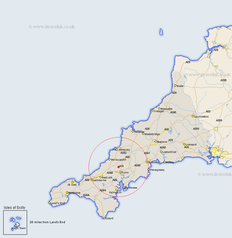
Cornwall Map Showing Location of St Allen
District: Carrick
Easting: 181631 Northing: 49017
Latitude: 50.3 Longitude: -5.07
 = St Allen
Easting: 181631 Northing: 49017
Latitude: 50.3 Longitude: -5.07
= St Allen
This St Allen map below is supplied by Google. Use the tools in the top left corner to zoom into street level or zoom out for a road map, you may also need to zoom in to see St Allen on the map. Click and drag the map to move around. If the map fails to load try and refresh your browser or zoom in or out (+ or -).
Update - it seems Google no longer allow people to use their maps for free! This St Allen map sometimes loads and sometimes gives a error. I am working on a solution.
Closest 30 Towns or Cities to St Allen (Population over 500)
Kenwyn 3.7km Truro 3.89km Perranzabuloe 6.98km Kea 7.51km Perranporth 8.12km Ladock 8.49km Probus 8.49km Chacewater 9.02km Cubert 9.92km St. Agnes 10.81km Saint Agnes 10.81km St Agnes 10.81km St Day 11.13km St. Day 11.13km Saint Day 11.13km Saint Feoch 11.18km Saint Feock 11.18km St Feock 11.18km St. Feoch 11.18km St Feoch 11.18km Feock 11.18km St. Feock 11.18km Tregoney 11.28km Crantock 11.67km Gwennap 11.68km Creed 11.99km St. Stephen 12.4km St Stephen 12.4km Saint Stephen 12.4km Newquay 13.03km