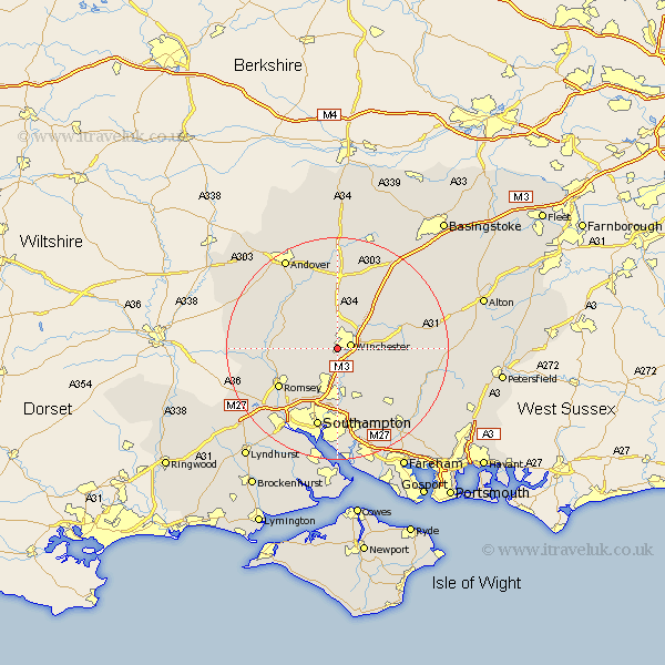
Hampshire Map Showing Location of Pitt
District: Winchester
Easting: 445556 Northing: 128110
Latitude: 51.05 Longitude: -1.35
 = Pitt
Easting: 445556 Northing: 128110
Latitude: 51.05 Longitude: -1.35
= Pitt
This Pitt map below is supplied by Google. Use the tools in the top left corner to zoom into street level or zoom out for a road map, you may also need to zoom in to see Pitt on the map. Click and drag the map to move around. If the map fails to load try and refresh your browser or zoom in or out (+ or -).
Update - it seems Google no longer allow people to use their maps for free! This Pitt map sometimes loads and sometimes gives a error. I am working on a solution.
Closest 30 Towns or Cities to Pitt (Population over 500)
Winchester 2.45km Sparsholt 2.98km Compton 3.88km Twyford 4.37km Kings Worthy 5.09km Hursley 5.09km Otterbourne 5.56km Owslebury 8.05km Eastleigh 9.26km Bishopstoke 9.34km Kings Somborne 9.5km Michelmersh 10.65km Michlemersh 10.65km Stockbridge 10.85km Micheldever 10.94km Wonston 11.36km Chilworth 12.06km Upham 12.35km Chilbolton 12.55km Cheriton 12.82km Romsey 12.85km Barton Stacey 13.03km Durley 13.14km New Alresford 13.33km Broughton 14.46km Bishops Waltham 14.51km Bishop's Waltham 14.51km West End 14.87km Southampton 14.87km Longparish 15.23km