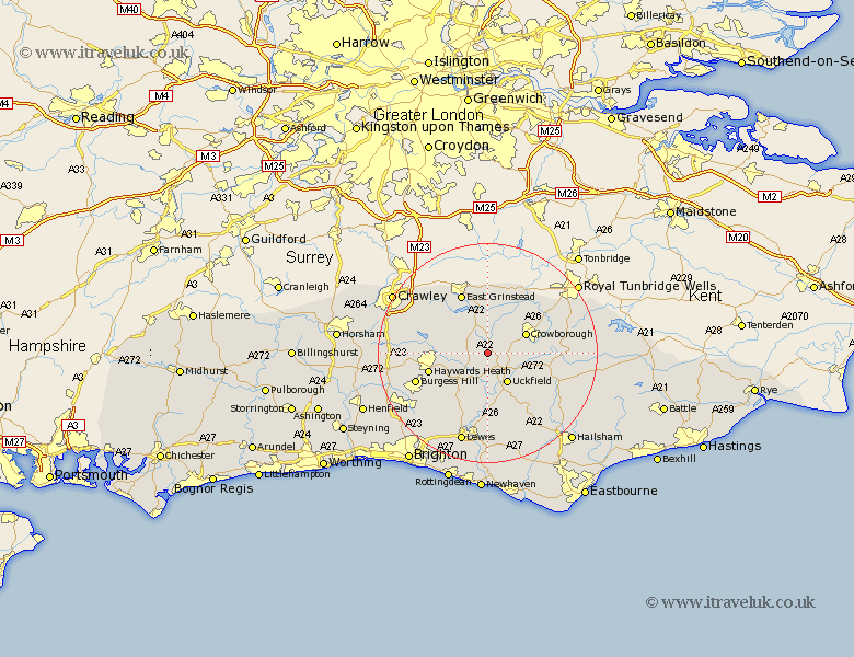
Sussex Map Showing Location of Nutley
District: Wealden
Easting: 543775 Northing: 126206
Latitude: 51.02 Longitude: 0.05
 = Nutley
Easting: 543775 Northing: 126206
Latitude: 51.02 Longitude: 0.05
= Nutley
This Nutley map below is supplied by Google. Use the tools in the top left corner to zoom into street level or zoom out for a road map, you may also need to zoom in to see Nutley on the map. Click and drag the map to move around. If the map fails to load try and refresh your browser or zoom in or out (+ or -).
Update - it seems Google no longer allow people to use their maps for free! This Nutley map sometimes loads and sometimes gives a error. I am working on a solution.
Closest 30 Towns or Cities to Nutley (Population over 500)
Fletching 3.89km Maresfield 4.39km Horsted Keynes 4.66km Newick 6.03km Uckfield 6.57km Buxted 6.91km Chailey 7.77km Crowborough 7.91km Lindfield 8.37km Hartfield 8.75km Isfield 9.35km Forest Row 9.42km Withyham 9.42km Framfield 9.44km Ardingly 9.51km Hadlow Down 10.04km Baywards Heath 11.13km Haywards Heath 11.13km Rotherfield 11.8km Turners Hill 11.9km Wivelsfield 11.92km East Grinstead 12.06km Balcombe 12.23km Cuckfield 12.82km South Nutfield 12.82km Barcombe Mills Station 13.03km East Hoathly 13.8km Burgess Hill 13.98km Mayfield 14.12km Ringmer 14.88km