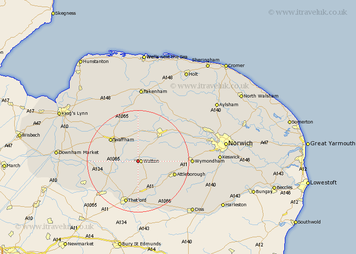
Norfolk Map Showing Location of Neaton
District: Breckland
Easting: 590876 Northing: 300308
Latitude: 52.57 Longitude: 0.82
 = Neaton
Easting: 590876 Northing: 300308
Latitude: 52.57 Longitude: 0.82
= Neaton
This Neaton map below is supplied by Google. Use the tools in the top left corner to zoom into street level or zoom out for a road map, you may also need to zoom in to see Neaton on the map. Click and drag the map to move around. If the map fails to load try and refresh your browser or zoom in or out (+ or -).
Update - it seems Google no longer allow people to use their maps for free! This Neaton map sometimes loads and sometimes gives a error. I am working on a solution.
Closest 30 Towns or Cities to Neaton (Population over 500)
Watton 1.13km Griston 3.86km Ashill 3.87km Carbooke 4.87km Carbrooke 4.87km Rockland St. Peter 7.71km Rockland 7.71km Rockland Saint Peter 7.71km Rockland St Peter 7.71km Shipdham 7.91km Hockham 8.68km Necton 9.53km Great Ellingham 10.8km Hingham 11.41km Palgrave 12.46km Great Palgrave 12.46km Mundford 13.49km Yaxham 13.72km Swaffham 13.73km Attleborough 14.62km Northwold 14.76km Dereham 15.17km East Dereham 15.17km Besthorpe 15.67km Litcham 16.72km East Harling 16.8km Quidenham 17.19km Thetford 17.28km Mattishall 17.32km Castle Acre 17.34km