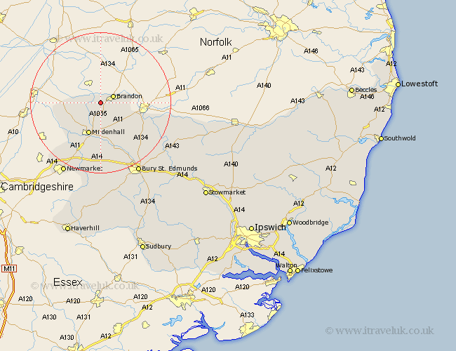
Suffolk Map Showing Location of Lakenheath
Population: 9168
Area Size (ha): 913
District: Forest Heath
Easting: 574465 Northing: 284842
Latitude: 52.43 Longitude: 0.57
 = Lakenheath
Area Size (ha): 913
District: Forest Heath
Easting: 574465 Northing: 284842
Latitude: 52.43 Longitude: 0.57
= Lakenheath
This Lakenheath map below is supplied by Google. Use the tools in the top left corner to zoom into street level or zoom out for a road map, you may also need to zoom in to see Lakenheath on the map. Click and drag the map to move around. If the map fails to load try and refresh your browser or zoom in or out (+ or -).
Update - it seems Google no longer allow people to use their maps for free! This Lakenheath map sometimes loads and sometimes gives a error. I am working on a solution.
Closest 30 Towns or Cities to Lakenheath (Population over 500)
Lakenheath 0km Lake Heath 0km Brandon 3.86km Eriswell 7.74km Mildenhall 9.86km Barnham 13.52km Risby 19.07km Honington 19.35km Troston 19.61km Fornham All Saints 20.62km Gazeley 20.66km Moulton 21.15km Barrow 22.27km Bury St. Edmunds 22.79km Bury Saint Edmunds 22.79km Bury St Edmunds 22.79km Newmarket 22.79km Great Barton 22.97km Bardwell 23.2km Ixworth 23.4km Exning 23.66km Barningham 24.44km Pakenham 25.91km Hopton 25.95km Stanton 26.08km Chevington 26.16km Hepworth 26.23km Thurston 26.53km Rushbrooke 27.66km Chedburgh 28km