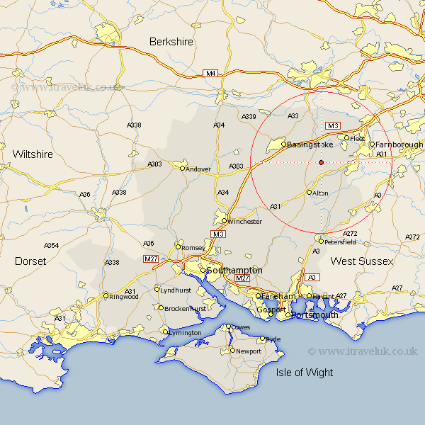
Hampshire Map Showing Location of Long Sutton
Population: 535
District: Hart
Easting: 474490 Northing: 146986
Latitude: 51.22 Longitude: -0.93
 = Long Sutton
District: Hart
Easting: 474490 Northing: 146986
Latitude: 51.22 Longitude: -0.93
= Long Sutton
This Long Sutton map below is supplied by Google. Use the tools in the top left corner to zoom into street level or zoom out for a road map, you may also need to zoom in to see Long Sutton on the map. Click and drag the map to move around. If the map fails to load try and refresh your browser or zoom in or out (+ or -).
Update - it seems Google no longer allow people to use their maps for free! This Long Sutton map sometimes loads and sometimes gives a error. I am working on a solution.
Closest 30 Towns or Cities to Long Sutton (Population over 500)
Long Sutton 0km Odiham 3.7km Upton Grey 4.64km Froyle 5.68km Hook 5.68km Crondall 5.8km Bentley 5.95km Winchfield 6.56km Rotherwick 7.76km Binsted 8.19km Basing 8.91km Hartley Wintney 9.9km Alton 9.91km Fleet 10.16km Sherfield upon Loddon 10.93km Sherfield 10.93km Basingstoke 11.83km Kingsley 12.05km Aldershot 12.18km Bordon 12.55km Bordon Camp 12.55km Farringdon 13.44km Faringdon 13.44km Upper Farringdon 13.44km Headley 13.78km Four Marks 13.78km Bramley 14.48km Medstead 14.49km Selborne 14.83km Farnborough 14.99km