Durham Map Showing Location of Long Newton
Easting: 437742 Northing: 515506
Latitude: 54.53 Longitude: -1.42
 = Long Newton
Latitude: 54.53 Longitude: -1.42
= Long Newton
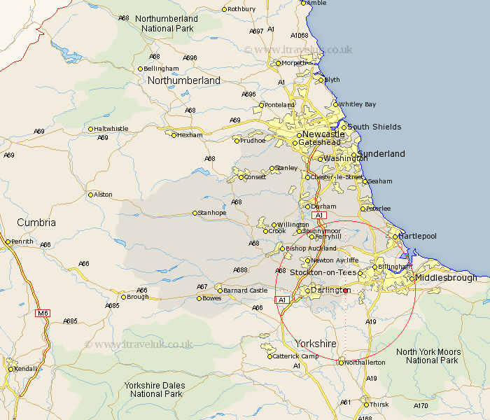
This Long Newton map below is supplied by Google. Use the tools in the top left corner to zoom into street level or zoom out for a road map, you may also need to zoom in to see Long Newton on the map. Click and drag the map to move around. If the map fails to load try and refresh your browser or zoom in or out (+ or -).
Update - it seems Google no longer allow people to use their maps for free! This Long Newton map sometimes loads and sometimes gives a error. I am working on a solution.
Closest 30 Towns or Cities to Long Newton (Population over 500)
Eaglescliffe 4.3km Egglescliffe 4.68km Carlton 5.66km Yarm 5.68km Yarm on Tees 5.68km Yarm-on-Tees 5.68km Stockton-on-Tees 6.78km Stockton on Tees 6.78km Stockton 6.78km Stillington 7.49km Thornaby 7.53km Thornaby on Tees 7.53km Thornaby-on-Tees 7.53km Hurworth 8.52km Grindon 9.52km Darlington 9.68km Billingham on Tees 10.56km Billingham-on-Tees 10.56km Billingham 10.56km Wolviston 12.64km Sedgefield 13.02km Newton Aycliffe 13.4km Greatham 16.22km Fishburn 16.71km Bishop Middleham 17.22km Trimdon 18.54km Shildon 18.7km Elwick 18.76km Ferryhill 18.76km West Cornforth 19.62km