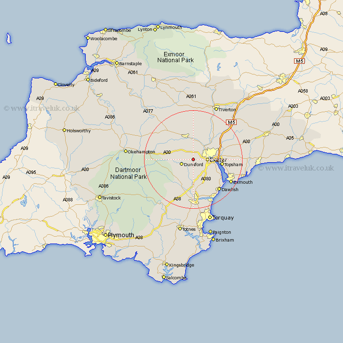
Devon Map Showing Location of Longdown
District: Teignbridge
Easting: 285842 Northing: 90239
Latitude: 50.7 Longitude: -3.62
 = Longdown
Easting: 285842 Northing: 90239
Latitude: 50.7 Longitude: -3.62
= Longdown
This Longdown map below is supplied by Google. Use the tools in the top left corner to zoom into street level or zoom out for a road map, you may also need to zoom in to see Longdown on the map. Click and drag the map to move around. If the map fails to load try and refresh your browser or zoom in or out (+ or -).
Update - it seems Google no longer allow people to use their maps for free! This Longdown map sometimes loads and sometimes gives a error. I am working on a solution.
Closest 30 Towns or Cities to Longdown (Population over 500)
Holcombe Burnell 2.2km Ide 3.52km Whitestone 3.88km Dunsford 5.05km Exeter 5.87km Tedburn Saint Mary 5.98km Tedburn St Mary 5.98km Tedburn St. Mary 5.98km Christow 6.04km Saint Cyres 7.51km Newton St Cyres 7.51km Newton St. Cyres 7.51km Newton Saint Cyres 7.51km St Cyres 7.51km St. Cyres 7.51km Cheriton Bishop 9.01km Crediton 9.56km Exminster 9.57km Moretonhampstead 10.92km Stoke Canon 11.06km Chudleigh 11.37km Lustleigh 11.64km Hennock 11.67km Drewsteignton 11.74km Topsham 11.89km Thorverton 12.57km Kenton 12.91km Sandford 13.44km Bovey Tracey 13.8km Copplestone 14.55km