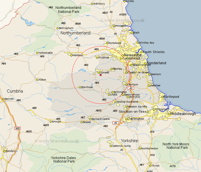
Durham Map Showing Location of Knitsley
District: Derwentside
Easting: 411774 Northing: 548744
Latitude: 54.83 Longitude: -1.82
 = Knitsley
Easting: 411774 Northing: 548744
Latitude: 54.83 Longitude: -1.82
= Knitsley
This Knitsley map below is supplied by Google. Use the tools in the top left corner to zoom into street level or zoom out for a road map, you may also need to zoom in to see Knitsley on the map. Click and drag the map to move around. If the map fails to load try and refresh your browser or zoom in or out (+ or -).
Update - it seems Google no longer allow people to use their maps for free! This Knitsley map sometimes loads and sometimes gives a error. I am working on a solution.
Closest 30 Towns or Cities to Knitsley (Population over 500)
Consett 2.14km Consetti 2.14km Castleside 3.2km Leadgate 3.86km Lanchester 5.65km Annfield Plain 5.65km Cornsay 6.42km Stanley 8.21km Esh 9.32km Burnopfield 9.8km Langley Park 10.3km Rowlands Gill 10.7km Tow Law 11.12km Edmondsley 11.89km Ushaw Moor 12.04km Witton Gilbert 12.32km Sacriston 12.94km Wolsingham 13.65km Whickham 14.01km Pelton 14.36km Ouston 14.59km Ouston Moor 14.59km Willington 14.97km Crook 15.76km Stanhope 15.82km Brandon 15.82km Chester-le-Street 16.12km Blaydon 16.6km Lamesley 16.68km Birtley 16.94km