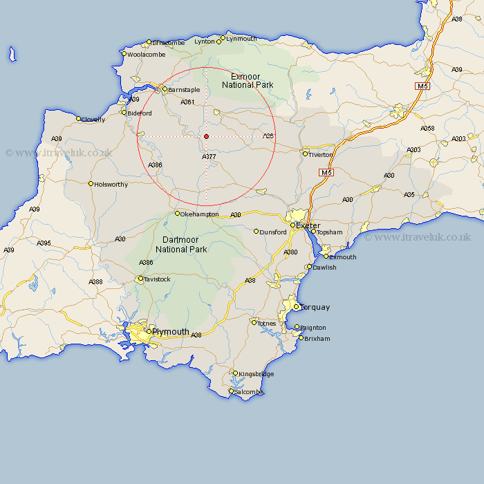
Devon Map Showing Location of Kings Nympton
District: North Devon
Easting: 267723 Northing: 118478
Latitude: 50.95 Longitude: -3.88
 = Kings Nympton
Easting: 267723 Northing: 118478
Latitude: 50.95 Longitude: -3.88
= Kings Nympton
This Kings Nympton map below is supplied by Google. Use the tools in the top left corner to zoom into street level or zoom out for a road map, you may also need to zoom in to see Kings Nympton on the map. Click and drag the map to move around. If the map fails to load try and refresh your browser or zoom in or out (+ or -).
Update - it seems Google no longer allow people to use their maps for free! This Kings Nympton map sometimes loads and sometimes gives a error. I am working on a solution.
Closest 30 Towns or Cities to Kings Nympton (Population over 500)
Chulmleigh 3.88km Burrington 5.03km Barrington 5.03km Chawleigh 6.57km South Molton 8.2km High Bickington 8.38km Chittlehampton 8.76km Lapford 10.95km Witheridge 12.25km North Molton 12.56km Swimbridge 12.56km Dolton 12.87km Morchard Bishop 14.53km Tawstock 16.11km North Tawton 16.72km Nymet Tracey 17.32km Bow 17.32km Great Torrington 18.68km Torrington 18.68km Barnstaple 18.86km Bratton Fleming 19.11km Sampford Courtnay 19.12km Sampford Courtenay 19.12km Sampford Courtney 19.12km Copplestone 19.12km Hatherleigh 19.62km Fremington 20.85km Sandford 21.23km Cheriton Fitzpaine 21.76km Langtree 22.5km