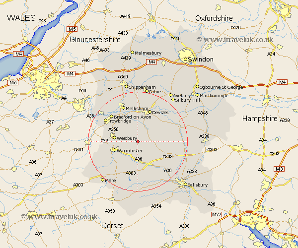
Wiltshire Map Showing Location of Imber
District: West Wiltshire
Easting: 396509 Northing: 148293
Latitude: 51.23 Longitude: -2.05
 = Imber
Easting: 396509 Northing: 148293
Latitude: 51.23 Longitude: -2.05
= Imber
This Imber map below is supplied by Google. Use the tools in the top left corner to zoom into street level or zoom out for a road map, you may also need to zoom in to see Imber on the map. Click and drag the map to move around. If the map fails to load try and refresh your browser or zoom in or out (+ or -).
Update - it seems Google no longer allow people to use their maps for free! This Imber map sometimes loads and sometimes gives a error. I am working on a solution.
Closest 30 Towns or Cities to Imber (Population over 500)
West Lavington 3.95km Edington 5.09km Erlestoke 5.68km Bratton 5.94km Lavington 7.24km Market Lavington 7.24km Heytesbury 7.24km Codford 9.26km Worton 9.35km Steeple Ashton 9.41km Westbury 9.47km Potterne 9.56km Warminster 10km Dilton 10.44km Urchfont 11km Shrewton 11.84km Longbridge Deverill 12.81km North Bradley 12.86km Rowde 13.03km Hilperton 13.12km Seend 13.18km Steeple Langford 13.78km Longford 13.78km Devizes 13.78km Southwick 13.92km Corsley 14.05km Semington 14.72km Bradford on Avon 15.25km Bradford-on-Avon 15.25km Roundway 15.54km