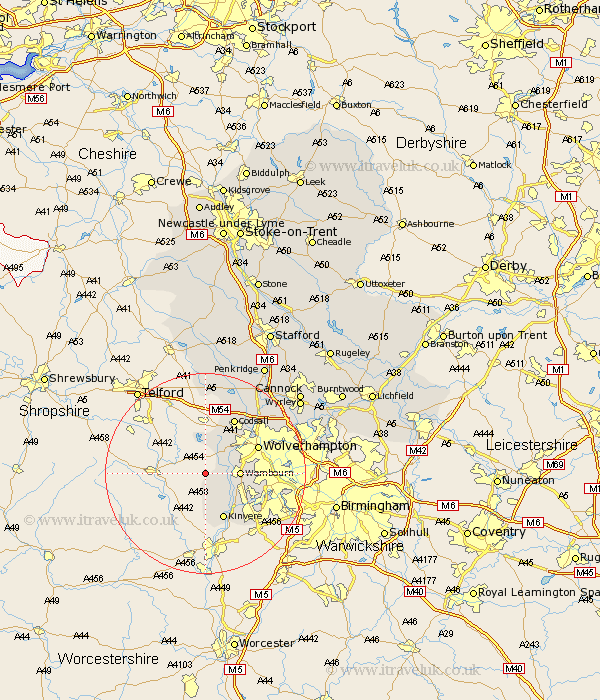
Staffordshire Map Showing Location of Healthton
District: South Staffordshire
Easting: 380783 Northing: 292904
Latitude: 52.53 Longitude: -2.28
 = Healthton
Easting: 380783 Northing: 292904
Latitude: 52.53 Longitude: -2.28
= Healthton
This Healthton map below is supplied by Google. Use the tools in the top left corner to zoom into street level or zoom out for a road map, you may also need to zoom in to see Healthton on the map. Click and drag the map to move around. If the map fails to load try and refresh your browser or zoom in or out (+ or -).
Update - it seems Google no longer allow people to use their maps for free! This Healthton map sometimes loads and sometimes gives a error. I am working on a solution.
Closest 30 Towns or Cities to Healthton (Population over 500)
Bobbington 1.85km Scisdon 4.34km Seisdon 4.34km Pattingham 5.67km Lower Penn 6.75km Wombourne 6.76km Wombourn 6.76km Himley 9.21km Kinvere 9.86km Wolverhampton 11.56km Codsall 12.46km Dudley 14.03km Bilston 15.11km Brewood 18.45km Weston-under-Lizard 18.54km Weston 18.54km Weston under Lizard 18.54km West Bromwich 19.26km Smethwick 19.53km Shareshill 20.06km Blymhill 20.39km Walsall 20.54km Wallsall 20.54km Wheaton Aston 20.88km Wyrley 23.52km Great Wyrley 23.52km Rushall 23.72km Church Eaton 24.33km Pelsall 24.36km Cannock 24.54km