Berkshire Map Showing Location of Hampstead Norris
Easting: 453230 Northing: 176371
Latitude: 51.48 Longitude: -1.23
 = Hampstead Norris
Latitude: 51.48 Longitude: -1.23
= Hampstead Norris
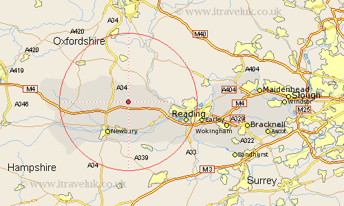
This Hampstead Norris map below is supplied by Google. Use the tools in the top left corner to zoom into street level or zoom out for a road map, you may also need to zoom in to see Hampstead Norris on the map. Click and drag the map to move around. If the map fails to load try and refresh your browser or zoom in or out (+ or -).
Update - it seems Google no longer allow people to use their maps for free! This Hampstead Norris map sometimes loads and sometimes gives a error. I am working on a solution.
Closest 30 Towns or Cities to Hampstead Norris (Population over 500)
Compton 3.89km Hermitage 4.36km Bucklebury 6.02km East Ilsley 6.55km Chieveley 6.86km Streatley 6.86km Cold Ash 7.5km Basildon 8.29km Bradfield 8.88km Beenham 9.39km Thatcham 9.55km Shaw 10.35km Pangbourne 10.39km Newbury 10.92km Greenham 11.65km Welford 12.12km Speen 12.3km Aldermaston 12.53km Theale 12.82km Brimpton 13.42km Tilehurst 14.34km Shefford 15.12km Great Shefford 15.12km West Shefford 15.12km Burghfield 16.67km Reading 17.1km East Garston 17.31km Kintbury 17.77km Stratfield Mortimer 19.84km Mortimer 19.84km