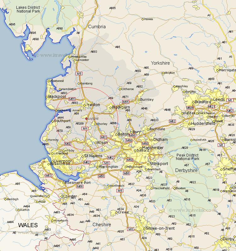
Lancashire Map Showing Location of Leyland
Population: 36712
Area Size (ha): 899
District: South Ribble
Easting: 353772 Northing: 421013
Latitude: 53.68 Longitude: -2.7
 = Leyland
Area Size (ha): 899
District: South Ribble
Easting: 353772 Northing: 421013
Latitude: 53.68 Longitude: -2.7
= Leyland
This Leyland map below is supplied by Google. Use the tools in the top left corner to zoom into street level or zoom out for a road map, you may also need to zoom in to see Leyland on the map. Click and drag the map to move around. If the map fails to load try and refresh your browser or zoom in or out (+ or -).
Update - it seems Google no longer allow people to use their maps for free! This Leyland map sometimes loads and sometimes gives a error. I am working on a solution.
Closest 30 Towns or Cities to Leyland (Population over 500)
Farrington 3.71km Farington 3.71km Euxton 4.31km Penrith 4.31km Eccleston 5.67km Croston 5.75km Heapey 5.79km Chorley 6.62km Bretherton 6.84km Much Hoole 6.84km Hoole 6.84km Hutton 7.08km Longton 7.56km Penwortham 7.73km Coppull 8.11km Hoghton 8.53km Mawdesley 8.61km Brinscall 8.78km Tarleton 8.97km Preston 9.34km Withnell 10.05km Samlesbury 10.77km Standish 11.34km Adlington 11.37km Lea 11.37km Lea Town 11.37km Rufford 11.49km Parbold 11.96km Haigh 12.04km Appley Bridge 13.01km