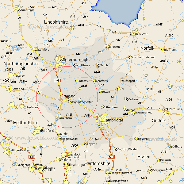
Cambridgeshire Map Showing Location of Great Stukeley
District: Huntingdonshire
Easting: 522588 Northing: 274004
Latitude: 52.35 Longitude: -0.2
 = Great Stukeley
Easting: 522588 Northing: 274004
Latitude: 52.35 Longitude: -0.2
= Great Stukeley
This Great Stukeley map below is supplied by Google. Use the tools in the top left corner to zoom into street level or zoom out for a road map, you may also need to zoom in to see Great Stukeley on the map. Click and drag the map to move around. If the map fails to load try and refresh your browser or zoom in or out (+ or -).
Update - it seems Google no longer allow people to use their maps for free! This Great Stukeley map sometimes loads and sometimes gives a error. I am working on a solution.
Closest 30 Towns or Cities to Great Stukeley (Population over 500)
Huntingdon 2.17km Durolipons 4.34km Godmanchester 4.34km Brampton 4.34km Brampton Grange 4.34km Alconbury 4.89km Wyton 5.96km Ellington 6.77km Hemingford 6.77km Hemingford Grey 6.77km Offord 7.42km Offord Cluny 7.42km West Hemingford 7.74km Hemingford Abbots 7.74km Grafham 7.94km Graffham 7.94km Buckden 8.16km Wistow 8.77km Spaldwick 9.25km Bury 10.05km Sawtry 10.31km Warboys 10.62km St Ives 10.63km St. Ives 10.63km Fen Stanton 10.63km Saint Ives 10.63km Great Paxton 11.18km Hilton 11.49km Little Paxton 11.63km Ramsey 12.47km