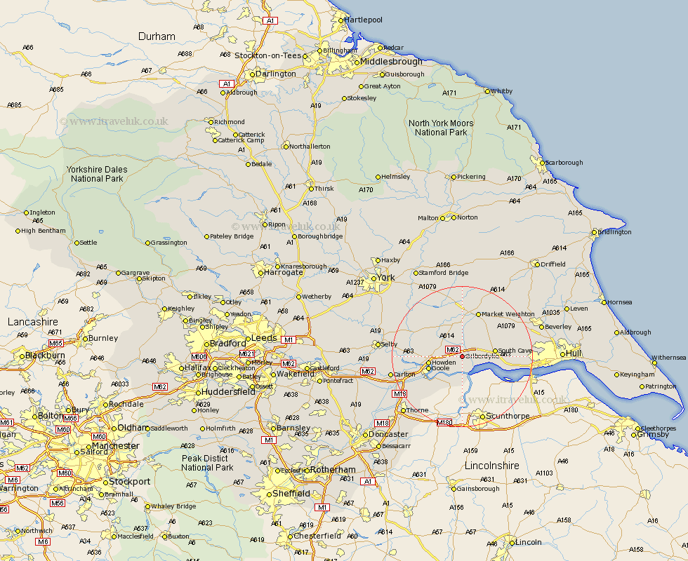
Yorkshire Map Showing Location of Gilberdike
Easting: 483516 Northing: 428950
Latitude: 53.75 Longitude: -0.73
 = Gilberdike
Latitude: 53.75 Longitude: -0.73
= Gilberdike
This Gilberdike map below is supplied by Google. Use the tools in the top left corner to zoom into street level or zoom out for a road map, you may also need to zoom in to see Gilberdike on the map. Click and drag the map to move around. If the map fails to load try and refresh your browser or zoom in or out (+ or -).
Update - it seems Google no longer allow people to use their maps for free! This Gilberdike map sometimes loads and sometimes gives a error. I am working on a solution.
Closest 30 Towns or Cities to Gilberdike (Population over 500)
Eastrington 3.29km North Cave 5.78km Newport 6.58km Hook 8.52km South Cave 8.96km Howden 8.96km Holme 9.52km Holme upon Spalding Moor 9.52km Goole 9.52km Swinefleet 9.92km Welton 11.12km Brough 11.33km Airmyn 11.57km Seaton Ross 12.39km Market Weighton 13.69km Bubwith 14.14km North Ferriby 15.79km Ferriby 15.79km Rawcliffe 16.07km Cliffe Common 16.54km Hemingbrough 16.54km Cliff Common Station 16.54km Swanland 16.55km Melbourne 16.68km Bishop Burton 17.91km Skidby 17.91km Kirk Ella 18.63km Barlow 18.63km Willerby 18.72km Carlton 19.45km