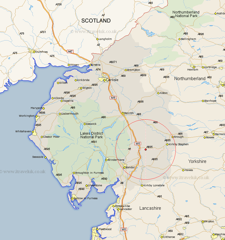
Cumbria Map Showing Location of Gaisgill
District: Eden
Easting: 364326 Northing: 504363
Latitude: 54.43 Longitude: -2.55
 = Gaisgill
Easting: 364326 Northing: 504363
Latitude: 54.43 Longitude: -2.55
= Gaisgill
This Gaisgill map below is supplied by Google. Use the tools in the top left corner to zoom into street level or zoom out for a road map, you may also need to zoom in to see Gaisgill on the map. Click and drag the map to move around. If the map fails to load try and refresh your browser or zoom in or out (+ or -).
Update - it seems Google no longer allow people to use their maps for free! This Gaisgill map sometimes loads and sometimes gives a error. I am working on a solution.
Closest 30 Towns or Cities to Gaisgill (Population over 500)
Tebay 2.84km Orton 3.86km Ravenstonedale 8.82km Crosby Ravensworth 9.52km Shap 11.95km Millthrop 13.14km Sedbergh 13.14km Milnthorpe 13.14km Kirkby Stephen 13.45km Appleby 15.44km Kendal 18.33km Kendall 18.33km Brough 18.63km Long Marston 18.66km Long Marton 18.66km Staveley 18.78km Dent 19.63km Kirkby Thore 20.39km Natland 20.48km Culgaith 24.31km Windermere 24.86km Levens 25.38km Kirkby Lonsdale 26.03km Kirkby Londsdale 26.03km Heversham 26.3km Ambleside 27.02km Dacre 27.39km Milnthorpe 27.89km Langwathby 28.8km Beetham 29.5km