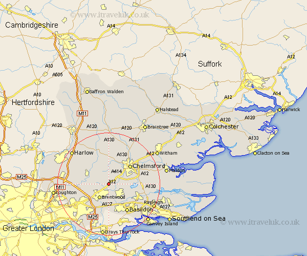
Essex Map Showing Location of Freyerning
District: Brentwood
Easting: 563650 Northing: 199139
Latitude: 51.67 Longitude: 0.37
 = Freyerning
Easting: 563650 Northing: 199139
Latitude: 51.67 Longitude: 0.37
= Freyerning
This Freyerning map below is supplied by Google. Use the tools in the top left corner to zoom into street level or zoom out for a road map, you may also need to zoom in to see Freyerning on the map. Click and drag the map to move around. If the map fails to load try and refresh your browser or zoom in or out (+ or -).
Update - it seems Google no longer allow people to use their maps for free! This Freyerning map sometimes loads and sometimes gives a error. I am working on a solution.
Closest 30 Towns or Cities to Freyerning (Population over 500)
Ingatestone 1.15km Mountnessing 3.89km Margaretting 3.91km Stock 4.96km Kelvedon Hatch 5.75km Brentwood 6.54km Billericay 6.54km Writtle 7.21km Galleywood 7.83km High Ongar 7.83km Ramsden Heath 8km Chipping Ongar 8.85km Herongate 9.28km Roxwell 9.33km West Hanningfield 9.38km Ingrave 9.56km Great Burstead 9.9km Great Baddow 9.91km Navestock 9.92km Fyfield 10.12km Stanford Rivers 10.35km Chelmsford 10.93km South Hanningfield 11km East Hanningfield 12.64km Wickford 12.74km Rettendon 12.78km Broomfield 13.08km Basildon 13.09km Great Waltham 14.18km Danbury 14.28km