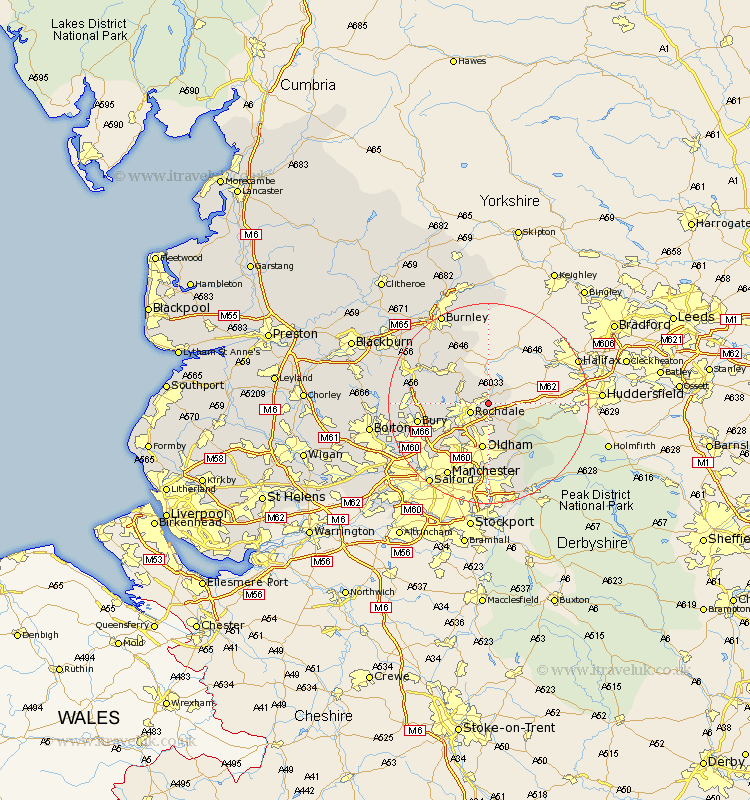
Lancashire Map Showing Location of Littleborough
Population: 13425
Area Size (ha): 279
District: Rochdale
Easting: 393388 Northing: 415227
Latitude: 53.63 Longitude: -2.1
 = Littleborough
Area Size (ha): 279
District: Rochdale
Easting: 393388 Northing: 415227
Latitude: 53.63 Longitude: -2.1
= Littleborough
This Littleborough map below is supplied by Google. Use the tools in the top left corner to zoom into street level or zoom out for a road map, you may also need to zoom in to see Littleborough on the map. Click and drag the map to move around. If the map fails to load try and refresh your browser or zoom in or out (+ or -).
Update - it seems Google no longer allow people to use their maps for free! This Littleborough map sometimes loads and sometimes gives a error. I am working on a solution.
Closest 30 Towns or Cities to Littleborough (Population over 500)
Wardle 2.88km Milnrow 3.7km Rochdale 3.78km Whitworth 5.8km Shaw 7.49km Royton 7.49km Uppermill 9.14km Delph 9.22km Bacup 9.23km Oldham 9.33km Heywood 9.49km Middleton 11.37km Failsworth 13.15km Edenfield 13.69km Bury 13.7km Mossley 14.08km Rawtenstall 14.17km Ramsbottom 14.29km Ashton 14.82km Ashton under Lyne 14.82km Ashton-under-Lyne 14.82km Tottington 15.83km Whitefield 16.13km Prestwich 16.43km Manchester 16.7km Droylesden 17km Droylsden 17km Haslingden 17.07km Radcliffe 17.97km Turton 19.78km